San Andreas fault
Numéro d’image : 11740374
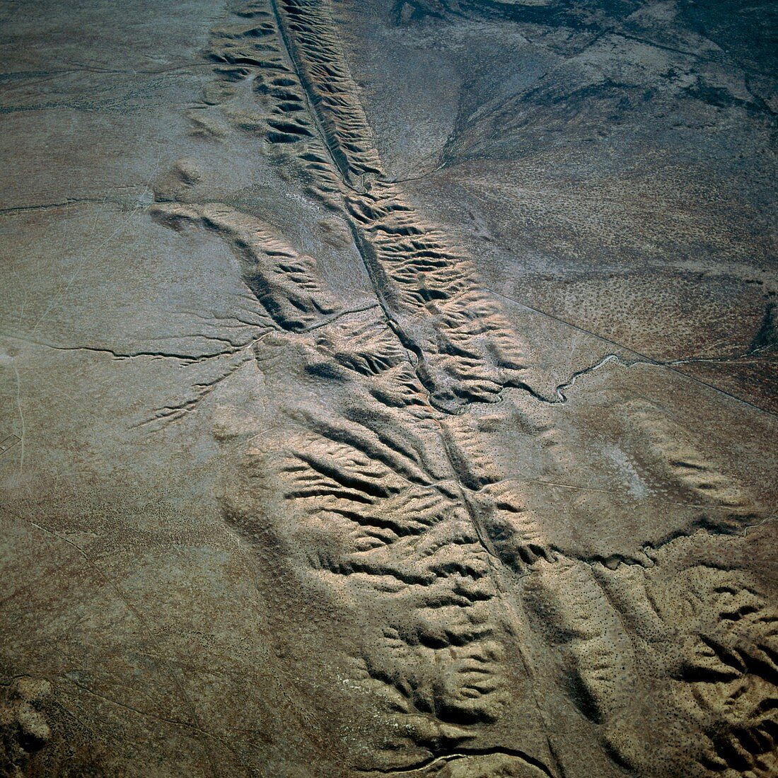
| San Andreas fault. Aerial photograph of the San Andreas fault crossing the Carrizo Plain of California,USA. The San Andreas fault is one of the world's great seismic faults,forming the boundary between the Pacific and North American tectonic plates. It is marked by the valley-like depression running from bottom right to top left. Pressure ridges line either side. These are formed by the stresses created by the opposing,lateral movements of the two tectonic plates. The San Andreas fault extends almost the full length of California and is responsible for major earthquakes | |
| Licence : | Droits gérés |
| Crédit: | Science Photo Library / Edmaier, Bernhard |
| Taille de l’image : | 4228 px × 4228 px |
| Model Release : | Non requis |
| Property Release : | Non requis |
| Restrictions : | - |
Prix pour cette image À partir de 45 €
Produit vendu
(Calendrier, Carte postale, Carte de vœux, Impression sur textile, Packaging etc)
À partir de 45 €
Usage commercial
(Affichage, Annonce presse, Annonce TV, Carte, Digital - hors rés. sociaux, Digital - rés. sociaux etc)
À partir de 45 €
Éditorial
(Digital, Journal, Livre, Livre pratique, Magazine, Télévision etc)
À partir de 60 €
Usage non-commercial
(Digital - hors rés. sociaux, Digital - rés. sociaux etc)
À partir de 120 €
Mots clés
- américain,
- Californie,
- Etats-Unis,
- faille de San Andreas,
- faille sismique,
- frontière,
- géographie,
- géologie,
- géologique,
- limite,
- marge,
- nord,
- pacifique,
- photo aérienne,
- photographie aérienne,
- plaine de Carrizo,
- plaques,
- plats,
- séismique,
- sismologie,
- sismologique,
- tectonique,
- tremblement de terre,
- USA