Earthquake risk map
Numéro d’image : 11740372
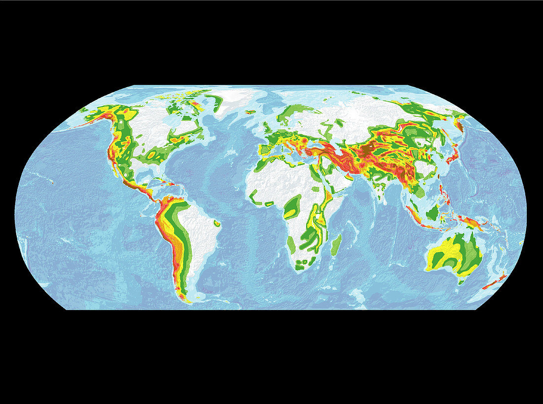
| Global earthquake risk map. This is the first global map of seismic risk. It gives an indication of the force of ground shaking or ground acceleration,rather than just where earthquakes are most likely. The colours relate to the force of an earthquake within the next 50 years. Areas of very high risk,such as the west coast of Central America,as well as Kyrgyzstan and Tajikistan (north of India),are dark brown & dark red. High risk is pink & red,moderate risk is yellow & orange,and low risk is white & green. This map was produced by the Global Seismic Hazard Assessment Program (GSHAP),an international project that involved 500 researchers | |
| Licence : | Droits gérés |
| Crédit: | Science Photo Library / GSHAP |
| Taille de l’image : | 3018 px × 2248 px |
| Model Release : | Non requis |
| Property Release : | Non requis |
| Restrictions : | - |
Prix pour cette image À partir de 45 €
Produit vendu
(Calendrier, Carte postale, Carte de vœux, Impression sur textile, Packaging etc)
À partir de 45 €
Usage commercial
(Affichage, Annonce presse, Annonce TV, Carte, Digital - hors rés. sociaux, Digital - rés. sociaux etc)
À partir de 45 €
Éditorial
(Digital, Journal, Livre, Livre pratique, Magazine, Télévision etc)
À partir de 60 €
Usage non-commercial
(Digital - hors rés. sociaux, Digital - rés. sociaux etc)
À partir de 120 €