Global distribution of large earthquakes 1963-87
Numéro d’image : 11740362
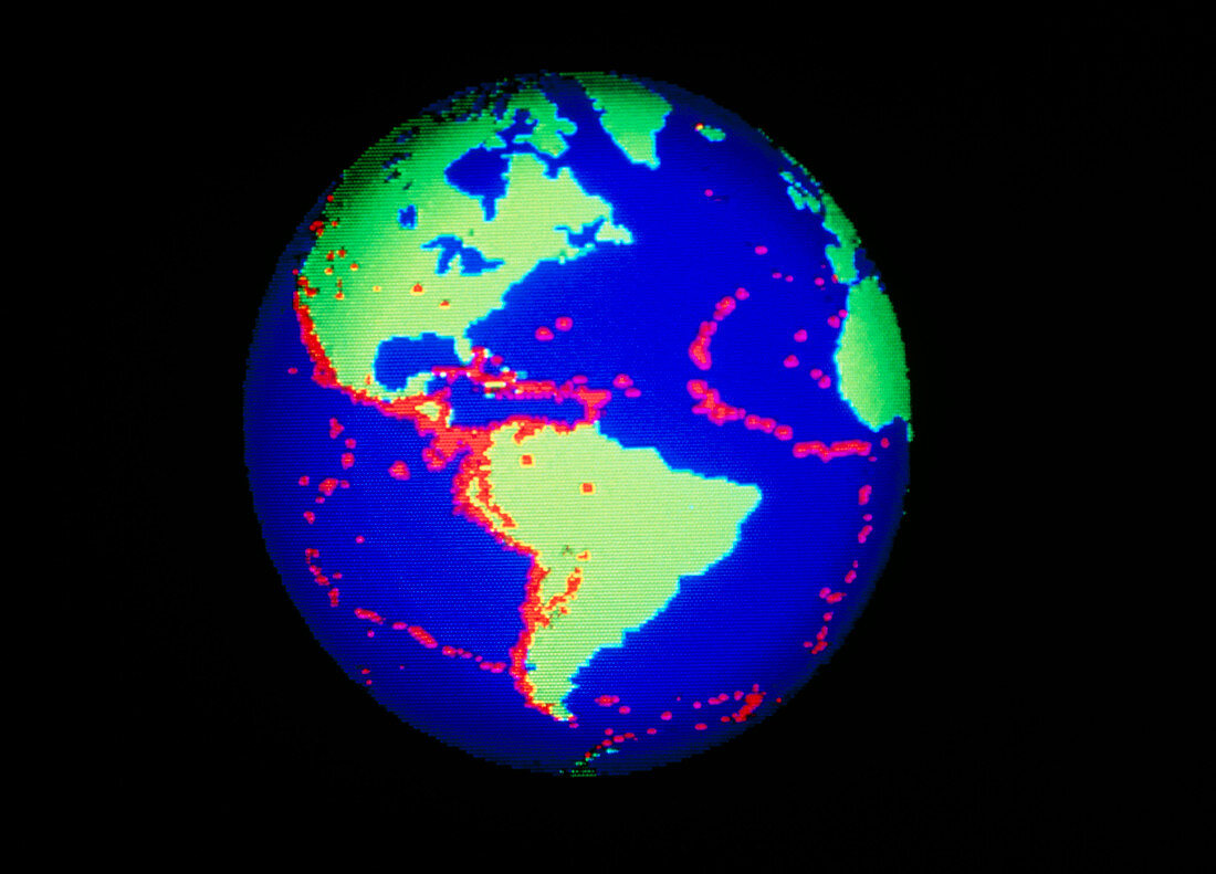
| Relationship between earthquakes and tectonic plate boundaries. Computer-enhanced global map showing the distribution (in red) of earthquakes of magnitude 5.5 or greater and depths of less than 50 kilometres in the period 1963-1987. This view shows the Americas. The earthquake centres correlate very well with oceanic plate margins,particularly on the west coast of the Americas and around Africa. On land tectonic margins,for example,those north of India in the Himalayas and in the African Rift Valleys (not visible in this image),the correlation is less evident. Original map data from the National Earthquake Information Centre,published on page 335 of Science vol. 256 17th April 1992 | |
| Licence : | Droits gérés |
| Crédit: | Science Photo Library / Kulyk, Mehau |
| Taille de l’image : | 4491 px × 3231 px |
| Model Release : | Non requis |
| Property Release : | Non requis |
| Restrictions : | - |
Prix pour cette image À partir de 45 €
Produit vendu
(Calendrier, Carte postale, Carte de vœux, Impression sur textile, Packaging etc)
À partir de 45 €
Usage commercial
(Affichage, Annonce presse, Annonce TV, Carte, Digital - hors rés. sociaux, Digital - rés. sociaux etc)
À partir de 45 €
Éditorial
(Digital, Journal, Livre, Livre pratique, Magazine, Télévision etc)
À partir de 60 €
Usage non-commercial
(Digital - hors rés. sociaux, Digital - rés. sociaux etc)
À partir de 120 €