Aerial photo of S.West across San Andreas fault
Numéro d’image : 11740356
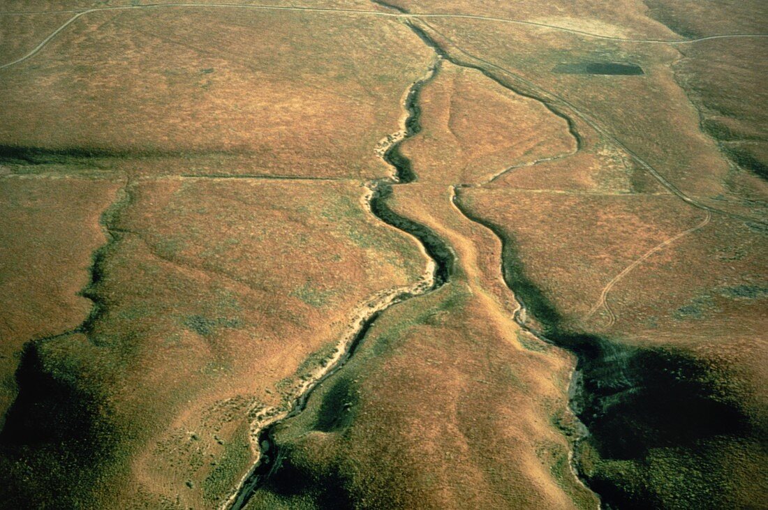
| Aerial photograph looking south-west across the San Andreas fault as it crosses the Carrizo Plain approximately 450km (300 miles) south of San Francisco & 160km (100 miles) north of Los Angeles. One of the world's great seismic faults,the San Andreas extends almost the full length of California & is responsible for major earthquakes. This image shows the right-lateral displacement of the pair of stream channels in the centre of the photo. The left-hand stream is offset by about 23 meters. The fault line runs from left to right,just above the centre of the image; stream flow is away from the viewer. Location: Carrizo Plain area,Sec. 3,T31S,R20E | |
| Licence : | Droits gérés |
| Crédit: | Science Photo Library / US Geological Survey |
| Taille de l’image : | 5188 px × 3449 px |
| Model Release : | Non requis |
| Property Release : | Non requis |
| Restrictions : | - |
Prix pour cette image À partir de 45 €
Produit vendu
(Calendrier, Carte postale, Carte de vœux, Impression sur textile, Packaging etc)
À partir de 45 €
Usage commercial
(Affichage, Annonce presse, Annonce TV, Carte, Digital - hors rés. sociaux, Digital - rés. sociaux etc)
À partir de 45 €
Éditorial
(Digital, Journal, Livre, Livre pratique, Magazine, Télévision etc)
À partir de 60 €
Usage non-commercial
(Digital - hors rés. sociaux, Digital - rés. sociaux etc)
À partir de 120 €