Aerial photo of San Andreas fault
Numéro d’image : 11740354
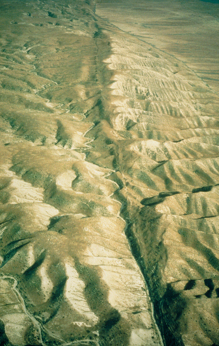
| Aerial photograph of the San Andreas fault as it crosses the Carrizo Plain approximately 450km (300 miles) south of San Francisco & 160km (100 miles) north of Los Angeles. One of the world's great seismic faults,the San Andreas extends almost the full length of California & is responsible for major earthquakes. A linear valley has eroded along the main track of the fault,running down the centre of the photograph. The black line on the Carrizo Plain at top right is not a fault but a fence line against which tumbleweed has collected. The desolate landscape consists of pressure ridges formed as a result of hundreds of fault movements. Location: Carrizo Plain area,Sec. 19,T32S,R22E | |
| Licence : | Droits gérés |
| Crédit: | Science Photo Library / US Geological Survey |
| Taille de l’image : | 3088 px × 4868 px |
| Model Release : | Non requis |
| Property Release : | Non requis |
| Restrictions : | - |
Prix pour cette image À partir de 45 €
Produit vendu
(Calendrier, Carte postale, Carte de vœux, Impression sur textile, Packaging etc)
À partir de 45 €
Usage commercial
(Affichage, Annonce presse, Annonce TV, Carte, Digital - hors rés. sociaux, Digital - rés. sociaux etc)
À partir de 45 €
Éditorial
(Digital, Journal, Livre, Livre pratique, Magazine, Télévision etc)
À partir de 60 €
Usage non-commercial
(Digital - hors rés. sociaux, Digital - rés. sociaux etc)
À partir de 120 €