San Andreas fault
Numéro d’image : 11740345
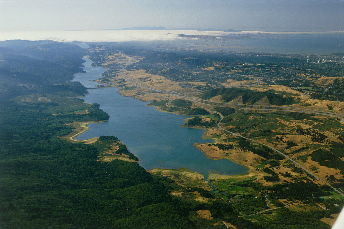
| Aerial photograph showing the line of the San Andreas fault as it runs along the foot of the Montara Mountains (at left),through the Crystal Spring Reservoir and San Andreas Lake beyond,in a roughly north- south direction. Skyline Boulevard is seen just to the right of the Reservoir. The city of San Francisco is seen in the distance. (June 1984) | |
| Licence : | Droits gérés |
| Crédit: | Science Photo Library / Parker, David |
| Taille de l’image : | 5165 px × 3442 px |
| Model Release : | Non requis |
| Property Release : | Non requis |
| Restrictions : | - |
Prix pour cette image À partir de 45 €
Produit vendu
(Calendrier, Carte postale, Carte de vœux, Impression sur textile, Packaging etc)
À partir de 45 €
Usage commercial
(Affichage, Annonce presse, Annonce TV, Carte, Digital - hors rés. sociaux, Digital - rés. sociaux etc)
À partir de 45 €
Éditorial
(Digital, Journal, Livre, Livre pratique, Magazine, Télévision etc)
À partir de 60 €
Usage non-commercial
(Digital - hors rés. sociaux, Digital - rés. sociaux etc)
À partir de 120 €