Hector Mine earthquake displacement
Numéro d’image : 11740322
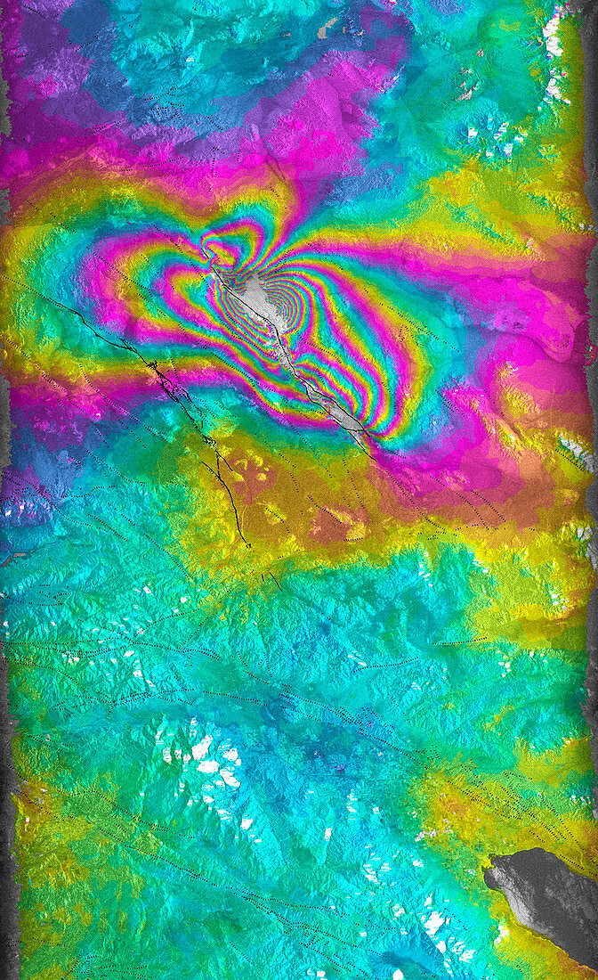
| Earthquake. Coloured satellite radar interfero- metry image of the Hector Mine earthquake of 16th October 1999 in California,USA. The coloured bands are contours,each colour cycle indicating 10 centimetres of ground displacement,increasing towards the fault (upper centre). This earthquake measured 7.1 on the Richter scale. The black line at upper left is the unrelated Landers fault. Radar measurements were taken before (15th Septe- mber) and after (20th October) the event by the European Space Agency's European Remote Sensing-2 (ERS-2) satellite. This technique allows movements as small as one millimetre to be seen,aiding research into where and how earthquakes occur | |
| Licence : | Droits gérés |
| Crédit: | Science Photo Library / ESA / JPL / NASA |
| Taille de l’image : | 2312 px × 3783 px |
| Model Release : | Non requis |
| Property Release : | Non requis |
| Restrictions : | - |
Prix pour cette image À partir de 45 €
Produit vendu
(Calendrier, Carte postale, Carte de vœux, Impression sur textile, Packaging etc)
À partir de 45 €
Usage commercial
(Affichage, Annonce presse, Annonce TV, Carte, Digital - hors rés. sociaux, Digital - rés. sociaux etc)
À partir de 45 €
Éditorial
(Digital, Journal, Livre, Livre pratique, Magazine, Télévision etc)
À partir de 60 €
Usage non-commercial
(Digital - hors rés. sociaux, Digital - rés. sociaux etc)
À partir de 120 €