1998 El Nino Pacific sea levels and temperatures
Numéro d’image : 11739667
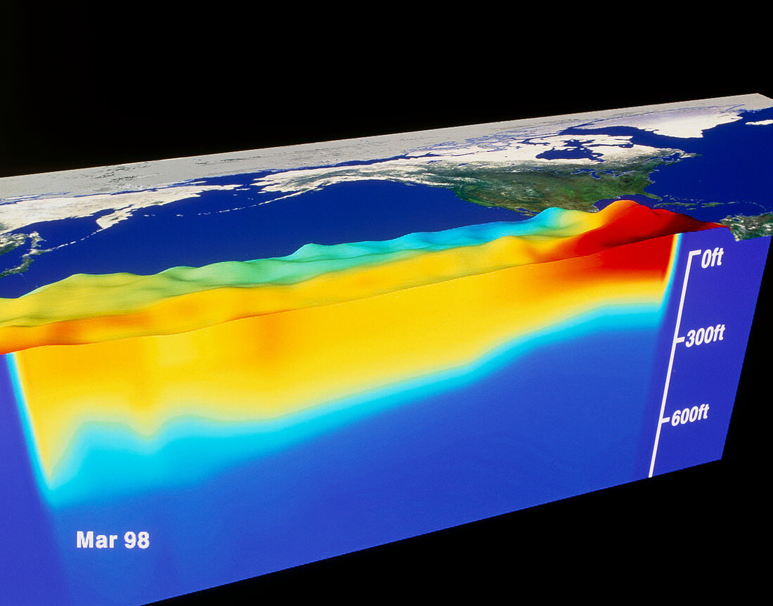
| El Nino. Computer artwork based on satellite data of sea level and temperature in the Pacific in March 1998 during an El Nino event. North is towards upper left,with the Americas at upper right and Asia at upper left. The three- dimensional sea relief map shows higher sea levels (not to scale) in the east. It was created using NASA TOPEX satellite imagery. Sea temperatures,from NOAA's AVHRR satellite sensor and TAO sea moorings,vary from red in the east (30 degrees celsius) to dark blue (8 degrees celsius). El Nino occurs when a warm tongue of water moves into the eastern Pacific,seriously affecting global weather patterns | |
| Licence : | Droits gérés |
| Crédit: | Science Photo Library / NASA |
| Taille de l’image : | 5375 px × 4211 px |
| Model Release : | Non requis |
| Property Release : | Non requis |
| Restrictions : | - |
Prix pour cette image À partir de 45 €
Produit vendu
(Calendrier, Carte postale, Carte de vœux, Impression sur textile, Packaging etc)
À partir de 45 €
Usage commercial
(Affichage, Annonce presse, Annonce TV, Carte, Digital - hors rés. sociaux, Digital - rés. sociaux etc)
À partir de 45 €
Éditorial
(Digital, Journal, Livre, Livre pratique, Magazine, Télévision etc)
À partir de 60 €
Usage non-commercial
(Digital - hors rés. sociaux, Digital - rés. sociaux etc)
À partir de 120 €