Phytoplankton in Gulf of Mexico (satellite image)
Numéro d’image : 11739652
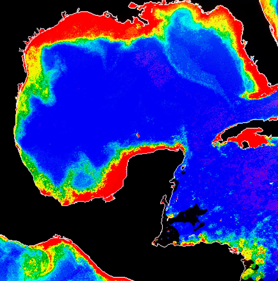
| False-colour satellite image of the Gulf of Mexico,showing the distribution of phytoplankton in the water. The colours represent varying phytoplankton densities from red (most dense) through yellow and green to blue (least dense). Land areas are black and the grey areas are data gaps. The shallow,plankton-rich coastal waters support large fisheries. The nutrient-rich waters flowing out of the Mississippi delta (centre top) produce a phytoplankton plume (pale blue) almost 800 km in length. The image was produced from data acquired by the Coastal Zone Colour Scanner,one of the instruments on NASA's Nimbus-7 satellite | |
| Licence : | Droits gérés |
| Crédit: | Science Photo Library / DR GENE FELDMAN, NASA GSFC |
| Taille de l’image : | 5069 px × 5117 px |
| Model Release : | Non requis |
| Property Release : | Non requis |
| Restrictions : | - |
Prix pour cette image À partir de 45 €
Produit vendu
(Calendrier, Carte postale, Carte de vœux, Impression sur textile, Packaging etc)
À partir de 45 €
Usage commercial
(Affichage, Annonce presse, Annonce TV, Carte, Digital - hors rés. sociaux, Digital - rés. sociaux etc)
À partir de 45 €
Éditorial
(Digital, Journal, Livre, Livre pratique, Magazine, Télévision etc)
À partir de 60 €
Usage non-commercial
(Digital - hors rés. sociaux, Digital - rés. sociaux etc)
À partir de 120 €