Phytoplankton from space
Numéro d’image : 11739651
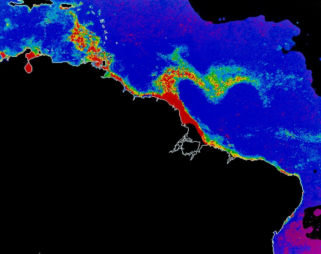
| False-colour satellite image of the Atlantic Ocean off the northeast coast of South America,showing the distribution of phytoplankton in the water. The colours represent varying phytoplankton densities from red (most dense) through yellow and green to blue (least dense). Land areas are black and regions where no measurements were possible are coloured grey. The phytoplankton distribution is dominated by the influence of the Amazon (right) and Orinoco (left) rivers,which discharge nutrient-rich waters into the ocean. The image was produced from data acquired by the Coastal Zone Colour Scanner on NASA's Nimbus-7 satellite | |
| Licence : | Droits gérés |
| Crédit: | Science Photo Library / DR GENE FELDMAN, NASA GSFC |
| Taille de l’image : | 4774 px × 3780 px |
| Model Release : | Non requis |
| Property Release : | Non requis |
| Restrictions : | - |
Prix pour cette image À partir de 45 €
Produit vendu
(Calendrier, Carte postale, Carte de vœux, Impression sur textile, Packaging etc)
À partir de 45 €
Usage commercial
(Affichage, Annonce presse, Annonce TV, Carte, Digital - hors rés. sociaux, Digital - rés. sociaux etc)
À partir de 45 €
Éditorial
(Digital, Journal, Livre, Livre pratique, Magazine, Télévision etc)
À partir de 60 €
Usage non-commercial
(Digital - hors rés. sociaux, Digital - rés. sociaux etc)
À partir de 120 €