ERS-1 tidal differences in Morecambe Bay,UK
Numéro d’image : 11739645
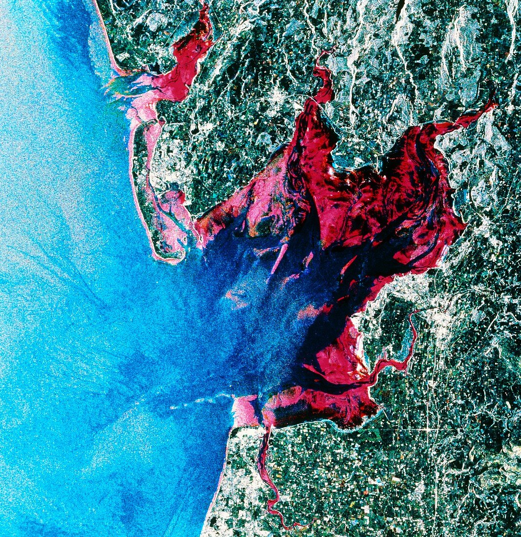
| Tidal differences in a coastal bay. ERS-1 radar image showing the difference between high and low tides in Morecambe Bay,north-west England. This image is composed of three views taken on different days. In one of these views the tide was out,exposing mudflats and sand banks which appear as magenta here. The highest point of the tide is at the border between the magenta and the grey tones of land permanently above water. The blue colour in the left is water in the Irish Sea. The data for this image were gathered by the ERS-1 European radar mapping satellite | |
| Licence : | Droits gérés |
| Crédit: | Science Photo Library / ESA, EURIMAGE |
| Taille de l’image : | 4622 px × 4771 px |
| Model Release : | Non requis |
| Property Release : | Non requis |
| Restrictions : |
|
Prix pour cette image À partir de 45 €
Produit vendu
(Calendrier, Carte postale, Carte de vœux, Impression sur textile, Packaging etc)
À partir de 45 €
Usage commercial
(Affichage, Annonce presse, Annonce TV, Carte, Digital - hors rés. sociaux, Digital - rés. sociaux etc)
À partir de 45 €
Éditorial
(Digital, Journal, Livre, Livre pratique, Magazine, Télévision etc)
À partir de 60 €
Usage non-commercial
(Digital - hors rés. sociaux, Digital - rés. sociaux etc)
À partir de 120 €