Satellite map of global wave heights
Numéro d’image : 11739610
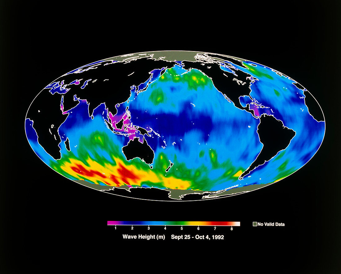
| Global map of mean wave heights. The map shows the mean height of ocean waves over the period 25 September to 4 October 1992,autumn in the northern hemisphere. Wave heights are colour coded,from magenta (less than 1 metre) through blue,green and yellow to red (7-8 metres). The largest waves are in the south Indian Ocean and the Southern Ocean near Antarctica,and are typical of the season (southern winter/spring). The data for this image were gathered by the TOPEX/Poseidon satellite in orbit 1336 km above the Earth using a radar altimeter | |
| Licence : | Droits gérés |
| Crédit: | Science Photo Library / NASA |
| Taille de l’image : | 5244 px × 4212 px |
| Model Release : | Non requis |
| Property Release : | Non requis |
| Restrictions : |
|
Prix pour cette image À partir de 45 €
Produit vendu
(Calendrier, Carte postale, Carte de vœux, Impression sur textile, Packaging etc)
À partir de 45 €
Usage commercial
(Affichage, Annonce presse, Annonce TV, Carte, Digital - hors rés. sociaux, Digital - rés. sociaux etc)
À partir de 45 €
Éditorial
(Digital, Journal, Livre, Livre pratique, Magazine, Télévision etc)
À partir de 60 €
Usage non-commercial
(Digital - hors rés. sociaux, Digital - rés. sociaux etc)
À partir de 120 €