Satellite image of the Atlantic Ocean
Numéro d’image : 11739601
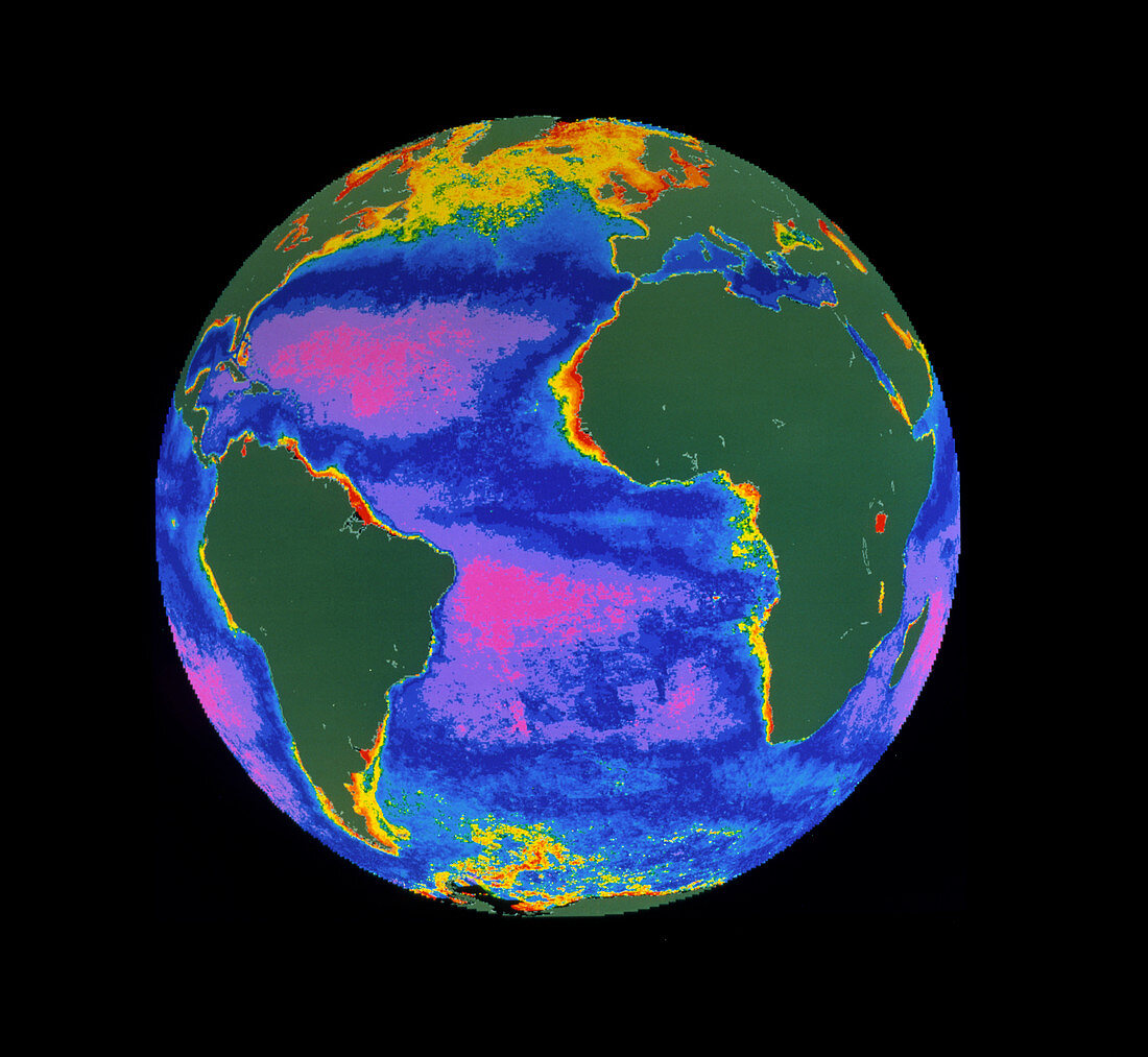
| False-colour satellite image of the Atlantic Ocean,showing the density and distribution of phytoplankton in the surface water. The colours represent varying phytoplankton densities from red (most dense) through yellow,green and blue to pink (least dense). Land areas are coloured grey. The highest phytoplankton densities occur in nutrient-rich coastal waters and as a seasonal bloom across the northern Atlantic. The image was produced from data acquired by the Coastal Zone Colour Scanner,one of the instruments on NASA's Nimbus-7 research satellite | |
| Licence : | Droits gérés |
| Crédit: | Science Photo Library / DR GENE FELDMAN, NASA GSFC |
| Taille de l’image : | 2949 px × 2716 px |
| Model Release : | Non requis |
| Property Release : | Non requis |
| Restrictions : | - |
Prix pour cette image À partir de 45 €
Produit vendu
(Calendrier, Carte postale, Carte de vœux, Impression sur textile, Packaging etc)
À partir de 45 €
Usage commercial
(Affichage, Annonce presse, Annonce TV, Carte, Digital - hors rés. sociaux, Digital - rés. sociaux etc)
À partir de 45 €
Éditorial
(Digital, Journal, Livre, Livre pratique, Magazine, Télévision etc)
À partir de 60 €
Usage non-commercial
(Digital - hors rés. sociaux, Digital - rés. sociaux etc)
À partir de 120 €