Fal-col satellite image of coastal waters (Peru)
Numéro d’image : 11739597
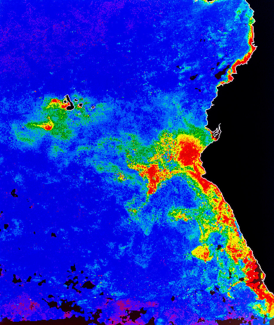
| False-colour satellite image of the coastal waters of Peru and Ecuador,showing the distribution of phytoplankton in the surface waters. The colours represent varying phytoplankton densities from red (most dense) through orange,yellow and green to blue (least dense). Land areas are black and regions where no measurements were possible are grey. The wind-driven upwelling of cool,nutrient- rich subsurface waters in this area causes the high phytoplankton concentrations which support some of the world's largest fisheries. The image was produced from data acquired by the Coastal Zone Colour Scanner on NASA's Nimbus-7 satellite | |
| Licence : | Droits gérés |
| Crédit: | Science Photo Library / DR GENE FELDMAN, NASA GSFC |
| Taille de l’image : | 3987 px × 4724 px |
| Model Release : | Non requis |
| Property Release : | Non requis |
| Restrictions : | - |
Prix pour cette image À partir de 45 €
Produit vendu
(Calendrier, Carte postale, Carte de vœux, Impression sur textile, Packaging etc)
À partir de 45 €
Usage commercial
(Affichage, Annonce presse, Annonce TV, Carte, Digital - hors rés. sociaux, Digital - rés. sociaux etc)
À partir de 45 €
Éditorial
(Digital, Journal, Livre, Livre pratique, Magazine, Télévision etc)
À partir de 60 €
Usage non-commercial
(Digital - hors rés. sociaux, Digital - rés. sociaux etc)
À partir de 120 €