B-15 iceberg
Numéro d’image : 11739194
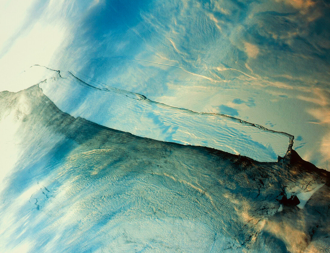
| B-15 iceberg. Satellite image of the B-15 iceberg (white,upper left to lower right) in Antarctica. This huge sheet of ice broke away from the Ross Ice Shelf near Roosevelt Island in March 2000. At around 300 kilometres in length and 40 kilometres wide,it is one of the biggest icebergs ever known. Image taken by the Moderate Resolution Imaging Spectrometer (MODIS) on NASA's Terra satellite | |
| Licence : | Droits gérés |
| Crédit: | Science Photo Library / NASA |
| Taille de l’image : | 4738 px × 3643 px |
| Model Release : | Non requis |
| Property Release : | Non requis |
| Restrictions : | - |
Prix pour cette image À partir de 45 €
Produit vendu
(Calendrier, Carte postale, Carte de vœux, Impression sur textile, Packaging etc)
À partir de 45 €
Usage commercial
(Affichage, Annonce presse, Annonce TV, Carte, Digital - hors rés. sociaux, Digital - rés. sociaux etc)
À partir de 45 €
Éditorial
(Digital, Journal, Livre, Livre pratique, Magazine, Télévision etc)
À partir de 60 €
Usage non-commercial
(Digital - hors rés. sociaux, Digital - rés. sociaux etc)
À partir de 120 €
Mots clés
- Antarctique,
- Antartica,
- B-15,
- congélation,
- étagère,
- feuille,
- figé,
- froid,
- gelé,
- géographie,
- géographique,
- glace,
- glacier,
- glaciers,
- grand,
- hiver,
- iceberg,
- icebergs,
- le plus grand,
- modis,
- NASA,
- nature,
- plate-forme,
- plateforme,
- polaire,
- Pôle Sud,
- pôles,
- quai,
- réchauffement climatique,
- représentation,
- résolution modérée,
- Ross,
- satellite,
- science de la terre,
- terra,
- terre