Map showing limit of Arctic ice pack
Numéro d’image : 11738768
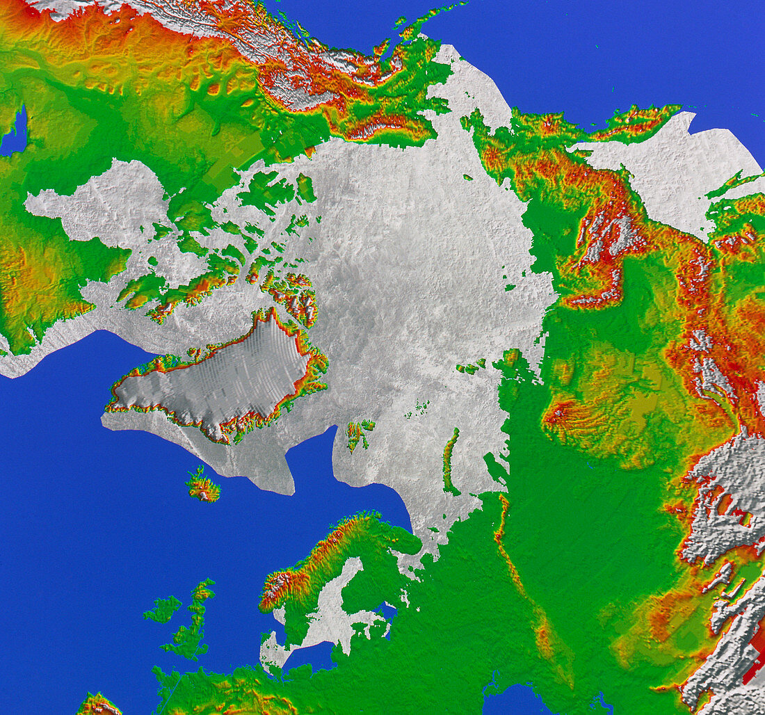
| Arctic ice cover. Map showing the maximum extent of the polar ice pack in the Arctic. The ice cap,shown as shaded white,covers the whole of the Arctic Ocean and northern semi-enclosed seas such as the Baltic Sea (bottom) and the Sea of Okhotsk (top right). The ice cap also covers some northern coastal areas,particularly in Canada and Alaska (upper left). The permanent ice cap is somewhat smaller,touching land only at the northern edge of Greenland and some of the Canadian islands | |
| Licence : | Droits gérés |
| Crédit: | Science Photo Library / NRSC / BP |
| Taille de l’image : | 4758 px × 4446 px |
| Model Release : | Non requis |
| Property Release : | Non requis |
| Restrictions : | - |
Prix pour cette image À partir de 45 €
Produit vendu
(Calendrier, Carte postale, Carte de vœux, Impression sur textile, Packaging etc)
À partir de 45 €
Usage commercial
(Affichage, Annonce presse, Annonce TV, Carte, Digital - hors rés. sociaux, Digital - rés. sociaux etc)
À partir de 45 €
Éditorial
(Digital, Journal, Livre, Livre pratique, Magazine, Télévision etc)
À partir de 60 €
Usage non-commercial
(Digital - hors rés. sociaux, Digital - rés. sociaux etc)
À partir de 120 €