Hurricane research
Numéro d’image : 11738664
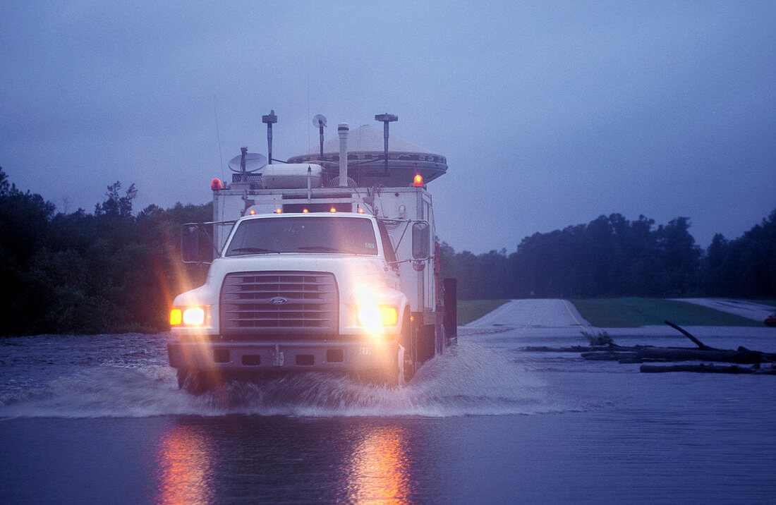
| Hurricane research vehicle on a flooded road as it studies Hurricane Floyd. This is a mobile radar vehicle called Doppler on Wheels (DOW 1). Tracking the development and movement of the hurricane on the ground allows valuable information to be gathered. Radar measurements of rainfall,wind speed and heading are all studied. The data can be used to advise people in the path of the storm of their best course of action. They are also used to help better predict the behaviour of subsequent hurricanes. Floyd hit the southwestern United States on 16th September 1999,and caused over 50 deaths. Photographed in North Carolina,USA | |
| Licence : | Droits gérés |
| Crédit: | Science Photo Library / JIM REED |
| Taille de l’image : | 5046 px × 3285 px |
| Model Release : | Non requis |
| Property Release : | Non requis |
| Restrictions : | - |
Prix pour cette image À partir de 45 €
Produit vendu
(Calendrier, Carte postale, Carte de vœux, Impression sur textile, Packaging etc)
À partir de 45 €
Usage commercial
(Affichage, Annonce presse, Annonce TV, Carte, Digital - hors rés. sociaux, Digital - rés. sociaux etc)
À partir de 45 €
Éditorial
(Digital, Journal, Livre, Livre pratique, Magazine, Télévision etc)
À partir de 60 €
Usage non-commercial
(Digital - hors rés. sociaux, Digital - rés. sociaux etc)
À partir de 120 €
Mots clés
- 1999,
- américain,
- atmosphère,
- camion,
- Caroline du Nord,
- chasseur,
- climat,
- data,
- donnée,
- doppler,
- Etats-Unis,
- FLOYD,
- horizontal,
- information,
- météo,
- météorologie,
- météorologique,
- mobile,
- N/A,
- ouragan,
- portable,
- portatif,
- prévision,
- prévisions,
- prévoir,
- radar,
- recherche,
- tempête,
- US,
- USA,
- véhicule