Flooded rivers
Numéro d’image : 11738360
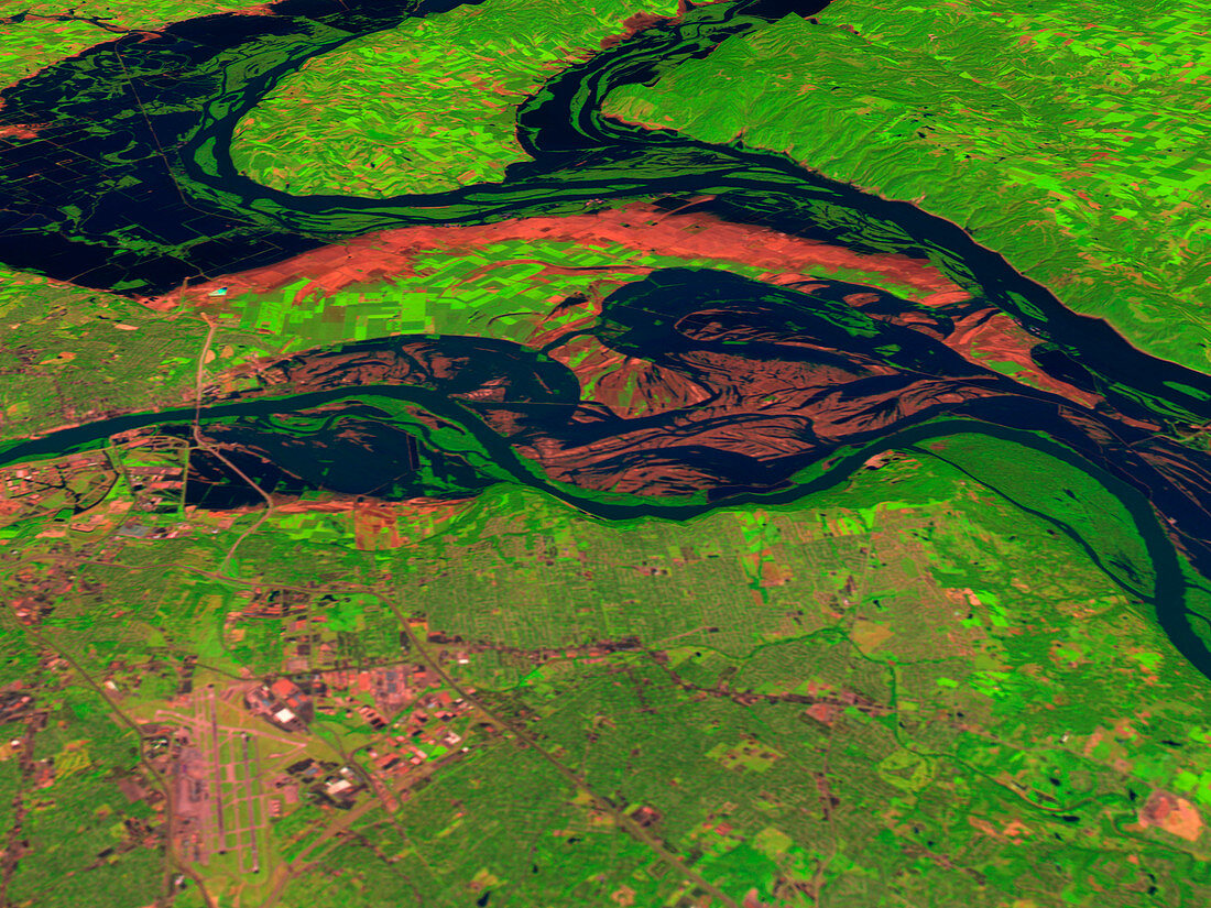
| Flooded rivers (image 2 of 2). Coloured three- dimensional computer image,based on satellite data,of three US rivers in flood. They are the Missouri (across centre),the Mississippi (upper left) and the Illinois (top centre). North is towards top. Bare soil (red) shows where the flood waters (dark blue) have receded. Vegetation is green. The record rainfall of summer 1993 caused the flooding. The image was produced from data collected on 14 August and 7 November 1993 by the Thematic Mapper on the US Landsat 5 satellite,along with USGS terrain elevation data. For the rivers before the flood see image E160/125 | |
| Licence : | Droits gérés |
| Crédit: | Science Photo Library / NASA's Goddard Space Flight Center |
| Taille de l’image : | 2560 px × 1920 px |
| Model Release : | Non requis |
| Property Release : | Non requis |
| Restrictions : | - |
Prix pour cette image À partir de 45 €
Produit vendu
(Calendrier, Carte postale, Carte de vœux, Impression sur textile, Packaging etc)
À partir de 45 €
Usage commercial
(Affichage, Annonce presse, Annonce TV, Carte, Digital - hors rés. sociaux, Digital - rés. sociaux etc)
À partir de 45 €
Éditorial
(Digital, Journal, Livre, Livre pratique, Magazine, Télévision etc)
À partir de 60 €
Usage non-commercial
(Digital - hors rés. sociaux, Digital - rés. sociaux etc)
À partir de 120 €
Mots clés
- 3 dimensions,
- 3D,
- agricole,
- agriculture,
- américain,
- champs,
- climat,
- cultures,
- eau,
- espace,
- Etats-Unis,
- fleuve Mississippi,
- géographie,
- hydrologie,
- Illinois,
- image satellite,
- inondation,
- inondé,
- météo,
- météorologie,
- météorologique,
- Missouri,
- terres arables,
- terres cultivables,
- tridimensionnel,
- tridimensionnelle,
- USA