Pre-flood Missouri River
Numéro d’image : 11738357
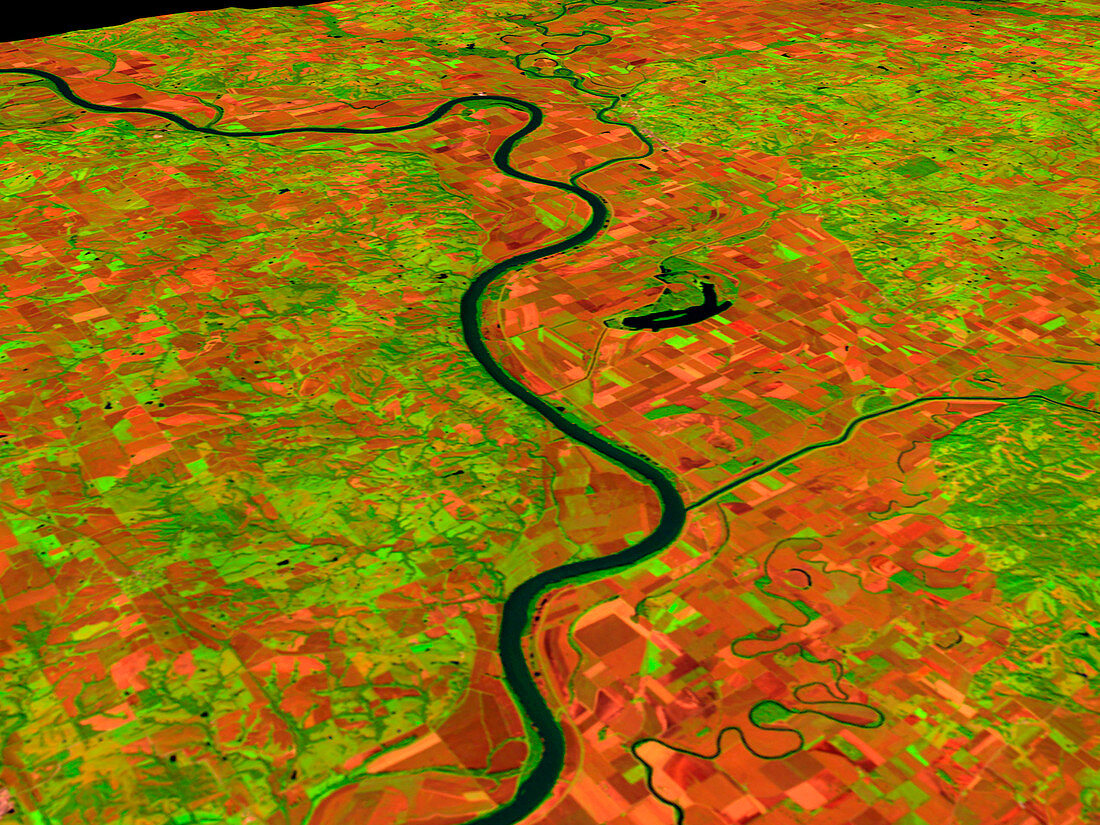
| Pre-flood Missouri River (image 1 of 2). Coloured three-dimensional computer image,based on satell- ite data,of the Missouri River,USA. The image was taken on 24 September 1992,before the river flooded in 1993. North is at right. Bare soil,such as in ploughed fields,is red,with vegetat- ion green and water black. The record rainfall of summer 1993 caused the river to burst its banks and flood a large area of land. A flood of this size should occur only once every 100 or more years. The image was produced from data collected by the Thematic Mapper on the US Landsat 5 satell- ite. For the river in flood see image E160/124 | |
| Licence : | Droits gérés |
| Crédit: | Science Photo Library / NASA's Goddard Space Flight Center |
| Taille de l’image : | 2560 px × 1920 px |
| Model Release : | Non requis |
| Property Release : | Non requis |
| Restrictions : | - |
Prix pour cette image À partir de 45 €
Produit vendu
(Calendrier, Carte postale, Carte de vœux, Impression sur textile, Packaging etc)
À partir de 45 €
Usage commercial
(Affichage, Annonce presse, Annonce TV, Carte, Digital - hors rés. sociaux, Digital - rés. sociaux etc)
À partir de 45 €
Éditorial
(Digital, Journal, Livre, Livre pratique, Magazine, Télévision etc)
À partir de 60 €
Usage non-commercial
(Digital - hors rés. sociaux, Digital - rés. sociaux etc)
À partir de 120 €
Mots clés
- 3 dimensions,
- 3D,
- agricole,
- agriculture,
- américain,
- avant,
- champs,
- climat,
- cultures,
- espace,
- Etats-Unis,
- fleuve Missouri,
- géographie,
- hydrologie,
- image satellite,
- inondation,
- météo,
- météorologie,
- météorologique,
- Missouri,
- précédent,
- terres arables,
- terres cultivables,
- tridimensionnel,
- tridimensionnelle,
- USA