TM merge highlighting flooding,St,Louis area
Numéro d’image : 11738351
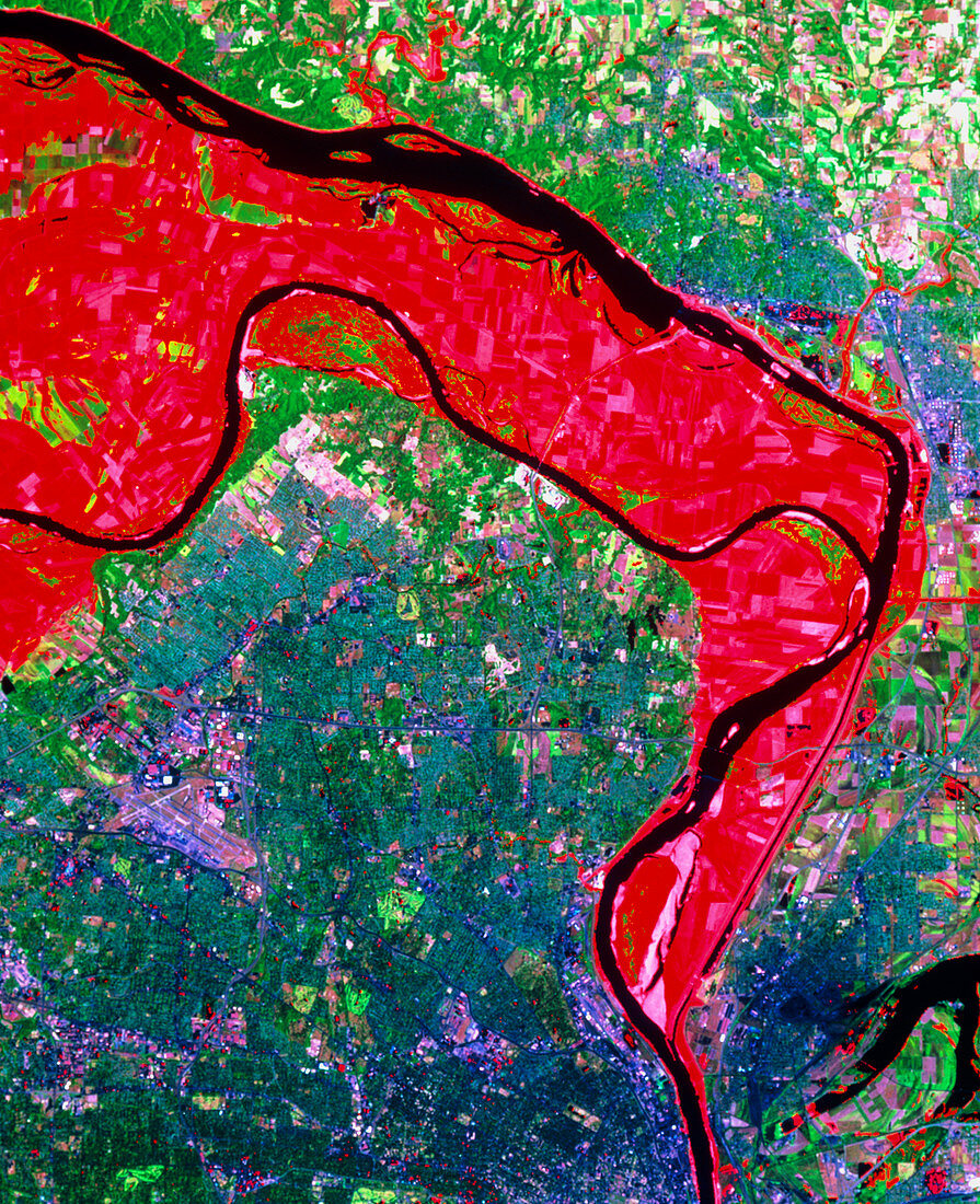
| St.Louis area during the 1993 floods. Enhanced colour satellite view of the area around St.Louis at the height of the flooding of the Mississippi and Missouri rivers in 1993. The city is the purple area near bottom centre. Red areas show the extent of the flooding of July 1993. This was highlighted by comparing an image made during the floods with an identical frame made three years earlier. The original (before the flood) river channels are shown in black; the Mississippi from top left to bottom right joined by the Missouri from centre left. The data were gathered by a Landsat satellite on 4 July 1988 and 18 July 1993 | |
| Licence : | Droits gérés |
| Crédit: | Science Photo Library / MDA Information Systems |
| Taille de l’image : | 3273 px × 4022 px |
| Model Release : | Non requis |
| Property Release : | Non requis |
| Restrictions : | - |
Prix pour cette image À partir de 45 €
Produit vendu
(Calendrier, Carte postale, Carte de vœux, Impression sur textile, Packaging etc)
À partir de 45 €
Usage commercial
(Affichage, Annonce presse, Annonce TV, Carte, Digital - hors rés. sociaux, Digital - rés. sociaux etc)
À partir de 45 €
Éditorial
(Digital, Journal, Livre, Livre pratique, Magazine, Télévision etc)
À partir de 60 €
Usage non-commercial
(Digital - hors rés. sociaux, Digital - rés. sociaux etc)
À partir de 120 €