Hurricane Katrina,radar image
Numéro d’image : 11738049
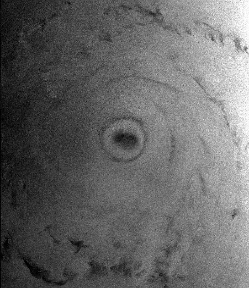
| Hurricane Katrina,satellite radar image. This image of Hurricane Katrina over the Gulf of Mexico on 28 August 2005 shows the reflected radar signal obtained by a satellite sensor. The radar signal penetrates the clouds and shows how rough the sea was beneath the clouds. The calm sea under the eye (black area,centre,about 50 kilometres across) is surrounded by white bands showing turbulent seas. At this point,Katrina was a Category Five hurricane with winds of over 250 kilometres per hour around the eye. The next day,Katrina made landfall,devastating the Gulf coast of the USA with immense damage and loss of life. Image taken by the ASAR sensor on the Envisat satellite | |
| Licence : | Droits gérés |
| Crédit: | Science Photo Library / ESA |
| Taille de l’image : | 1077 px × 1248 px |
| Model Release : | Non requis |
| Property Release : | Non requis |
| Restrictions : |
|
Prix pour cette image À partir de 45 €
Produit vendu
(Calendrier, Carte postale, Carte de vœux, Impression sur textile, Packaging etc)
À partir de 45 €
Usage commercial
(Affichage, Annonce presse, Annonce TV, Carte, Digital - hors rés. sociaux, Digital - rés. sociaux etc)
À partir de 45 €
Éditorial
(Digital, Journal, Livre, Livre pratique, Magazine, Télévision etc)
À partir de 60 €
Usage non-commercial
(Digital - hors rés. sociaux, Digital - rés. sociaux etc)
À partir de 120 €
Mots clés
- 2005,
- 21ème siècle,
- capteur,
- climat,
- de l'espace,
- Envisat,
- extrême,
- Golfe du Mexique,
- image satellite,
- mer,
- météo,
- météorologie,
- météorologique,
- monochrome,
- n/b,
- noir et blanc,
- noir-et-blanc,
- oeil,
- ouragan,
- ouragan Katrina,
- radar,
- radar à synthèse d'ouverture avancé,
- radar synthèse ouverture avancé,
- satellite,
- senseur,
- surface,
- tempête grave,
- tempête importante,
- tempête tropicale,
- vague,
- vagues,
- XX1ème siècle