Hurricane Mitch
Numéro d’image : 11737978
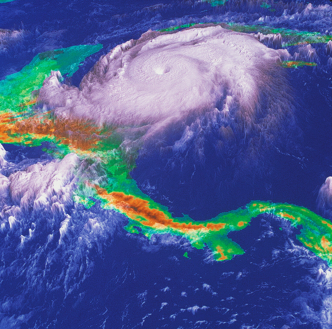
| Hurricane Mitch. Coloured three-dimensional computer image,based on satellite data,of Hurricane Mitch (white cloud swirl,upper centre). Mountainous areas of Central America (green) are orange. The hurricane is off the coast of Honduras (upper left,mostly obscured). North is at top. The hurricane produced winds of over 200 miles per hour and heavy rain that caused flooding and land- slides. Over 11,000 people were killed and damage was estimated at 5 billion dollars. This image,based on data from an American GOES satellite,shows the hurricane at 13:15 on 26 October 1998,three days before it made landfall on Honduras | |
| Licence : | Droits gérés |
| Crédit: | Science Photo Library / NASA's Goddard Space Flight Center |
| Taille de l’image : | 3781 px × 3747 px |
| Model Release : | Non requis |
| Property Release : | Non requis |
| Restrictions : | - |
Prix pour cette image À partir de 45 €
Produit vendu
(Calendrier, Carte postale, Carte de vœux, Impression sur textile, Packaging etc)
À partir de 45 €
Usage commercial
(Affichage, Annonce presse, Annonce TV, Carte, Digital - hors rés. sociaux, Digital - rés. sociaux etc)
À partir de 45 €
Éditorial
(Digital, Journal, Livre, Livre pratique, Magazine, Télévision etc)
À partir de 60 €
Usage non-commercial
(Digital - hors rés. sociaux, Digital - rés. sociaux etc)
À partir de 120 €