Satellite image of Hurricane Floyd
Numéro d’image : 11737976
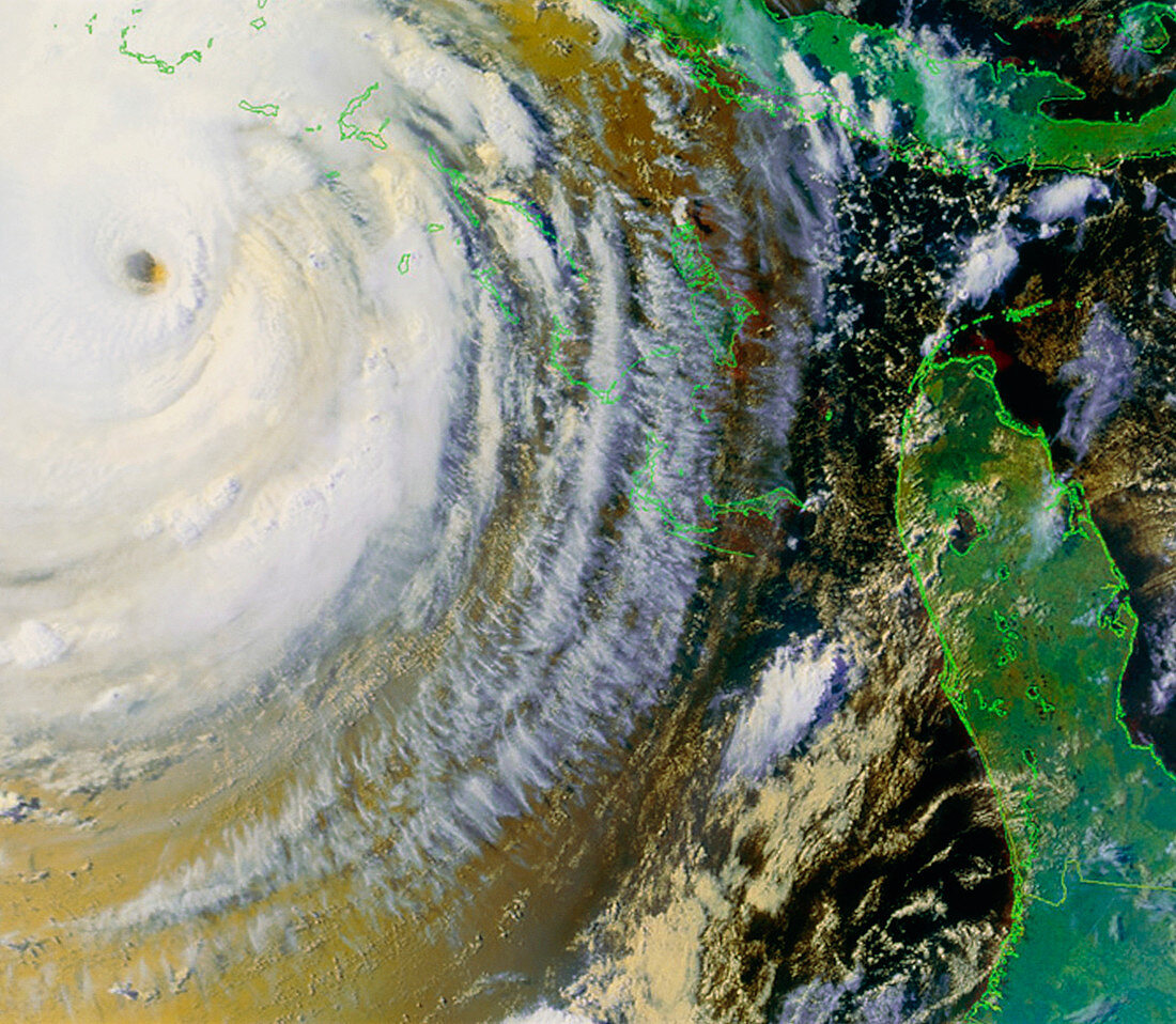
| Hurricane Floyd. Combined visible and infrared satellite image of Hurricane Floyd in the Atlantic Ocean off the coast of Florida (upper left),USA. North is at top. The hurricane is the swirl of white clouds around the central hole (the eye). Land,such as Cuba (bottom left),is green and water is brown. The eye contains calmer cloud-free air at very low pressure. Around it winds reached over 140 miles per hour. After devastating the Bahamas,Hurricane Floyd hit Florida on September 16,going on to cause 40 deaths. Hurricanes are caused by large-scale evaporation and convection in warm tropical seas. Image taken on 13 September 1999 by the American NOAA-15 satellite | |
| Licence : | Droits gérés |
| Crédit: | Science Photo Library / NASA |
| Taille de l’image : | 5013 px × 4368 px |
| Model Release : | Non requis |
| Property Release : | Non requis |
| Restrictions : | - |
Prix pour cette image À partir de 45 €
Produit vendu
(Calendrier, Carte postale, Carte de vœux, Impression sur textile, Packaging etc)
À partir de 45 €
Usage commercial
(Affichage, Annonce presse, Annonce TV, Carte, Digital - hors rés. sociaux, Digital - rés. sociaux etc)
À partir de 45 €
Éditorial
(Digital, Journal, Livre, Livre pratique, Magazine, Télévision etc)
À partir de 60 €
Usage non-commercial
(Digital - hors rés. sociaux, Digital - rés. sociaux etc)
À partir de 120 €