Coloured satellite image of Hurricane Linda
Numéro d’image : 11737970
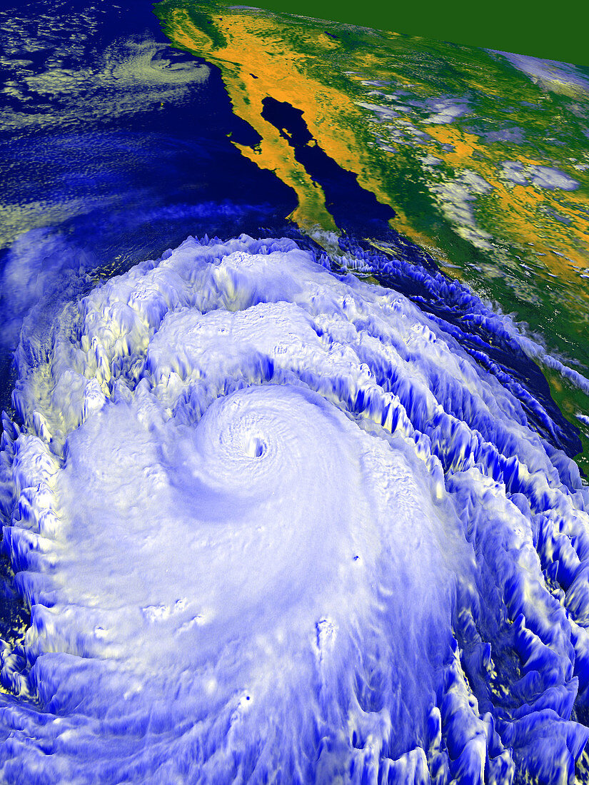
| Hurricane Linda. Coloured computer three- dimensional reconstruction,based on satellite data,of Hurricane Linda off the coast of Mexico (top right). North is towards top left. The hurricane is the swirl of clouds surrounding the central eye (lower right),an area of calmer,cloud-free air at very low pressure. Winds reached almost 190 miles per hour around the eye,making this the strongest hurricane on record in the Eastern Pacific (blue). Hurricanes form in the tropics due to large-scale evaporation and convection over warm seas. Image taken on 12 September 1997 by the American GOES-9 satellite | |
| Licence : | Droits gérés |
| Crédit: | Science Photo Library / NASA's Goddard Space Flight Center |
| Taille de l’image : | 1200 px × 1600 px |
| Model Release : | Non requis |
| Property Release : | Non requis |
| Restrictions : | - |
Prix pour cette image À partir de 45 €
Produit vendu
(Calendrier, Carte postale, Carte de vœux, Impression sur textile, Packaging etc)
À partir de 45 €
Usage commercial
(Affichage, Annonce presse, Annonce TV, Carte, Digital - hors rés. sociaux, Digital - rés. sociaux etc)
À partir de 45 €
Éditorial
(Digital, Journal, Livre, Livre pratique, Magazine, Télévision etc)
À partir de 60 €
Usage non-commercial
(Digital - hors rés. sociaux, Digital - rés. sociaux etc)
À partir de 120 €