Coloured satellite image showing Hurricane Hugo
Numéro d’image : 11737968
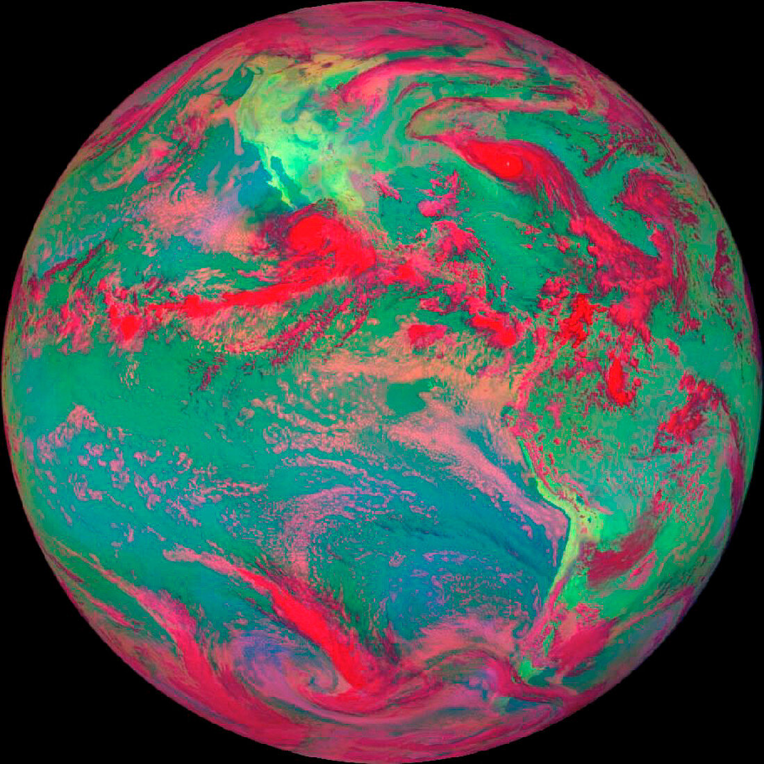
| Hurricane Hugo. Coloured satellite image showing Hurricane Hugo the day before it struck the U.S. The hurricane (red) is approaching the Eastern U.S. coast and is positioned in the Atlantic Ocean. Visible light such as that from clouds is red,while infrared is green and blue. Hugo had maximum sustained wind speeds of 260 km per hour and left a trail of destruction across the Leeward Islands,the Virgin Islands,Puerto Rico and South and North Carolina. Damage was estimated at ten billion U.S. dollars and 49 lives were lost. This image was taken by GOES-7 (Geostationary Operatio- nal Environmental Satellite) on 21 September 1989 | |
| Licence : | Droits gérés |
| Crédit: | Science Photo Library / NASA's Goddard Space Flight Center |
| Taille de l’image : | 912 px × 912 px |
| Model Release : | Non requis |
| Property Release : | Non requis |
| Restrictions : | - |
Prix pour cette image À partir de 45 €
Produit vendu
(Calendrier, Carte postale, Carte de vœux, Impression sur textile, Packaging etc)
À partir de 45 €
Usage commercial
(Affichage, Annonce presse, Annonce TV, Carte, Digital - hors rés. sociaux, Digital - rés. sociaux etc)
À partir de 45 €
Éditorial
(Digital, Journal, Livre, Livre pratique, Magazine, Télévision etc)
À partir de 60 €
Usage non-commercial
(Digital - hors rés. sociaux, Digital - rés. sociaux etc)
À partir de 120 €