Hurricane Hugo,satellite image
Numéro d’image : 11737960
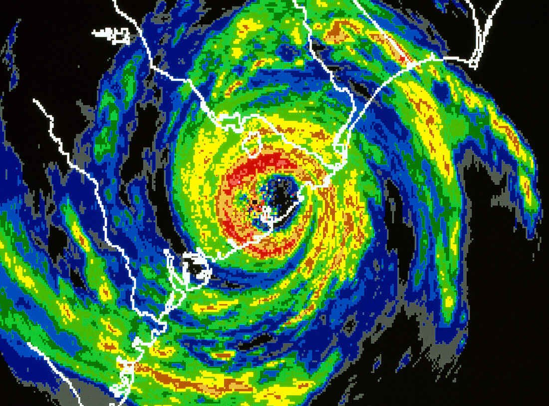
| Hurricane Hugo. Coloured satellite radar image of hurricane Hugo as it approached the coastline of South Carolina,USA. The image shows cloud cover from grey (lightest) to red (heaviest). The hurricane consists of thick clouds which swirl around a central clear,calm "eye". Hugo began as a cluster of storms detected off the coast of Africa on September 9th. With maximum sustained wind speeds of 260 kilometres per hour,Hugo left a trail of destruction across the Leeward Islands,the Virgin Islands,Puerto Rico and South and North Carolina. Damage was estimated at ten billion U.S. dollars and over 50 lives were lost. Image taken on 22 September 1989 | |
| Licence : | Droits gérés |
| Crédit: | Science Photo Library / NASA |
| Taille de l’image : | 4895 px × 3616 px |
| Model Release : | Non requis |
| Property Release : | Non requis |
| Restrictions : | - |
Prix pour cette image À partir de 45 €
Produit vendu
(Calendrier, Carte postale, Carte de vœux, Impression sur textile, Packaging etc)
À partir de 45 €
Usage commercial
(Affichage, Annonce presse, Annonce TV, Carte, Digital - hors rés. sociaux, Digital - rés. sociaux etc)
À partir de 45 €
Éditorial
(Digital, Journal, Livre, Livre pratique, Magazine, Télévision etc)
À partir de 60 €
Usage non-commercial
(Digital - hors rés. sociaux, Digital - rés. sociaux etc)
À partir de 120 €