Hurricane Allen in 3-D
Numéro d’image : 11737933
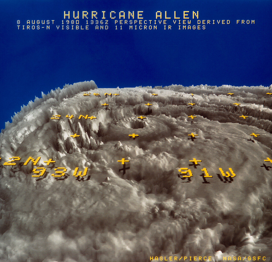
| Computer-generated perspective view of Hurricane Allen,seen over the Gulf of Mexico on 8 August 1980. The superimposed grid shows latitude and longitude. The image was produced from two TIROS-N satellite images,one taken in visible light,the other in the infrared (at a wavelength of 11 microns). A computer uses the two data sets to calculate the heights of the cloud tops and to create a 3-D computer model of the storm. A 2- D image can then be generated,viewing the hurricane from any chosen height and angle | |
| Licence : | Droits gérés |
| Crédit: | Science Photo Library / HASLER & PIERCE, NASA GSFC |
| Taille de l’image : | 4370 px × 4211 px |
| Model Release : | Non requis |
| Property Release : | Non requis |
| Restrictions : | - |
Prix pour cette image À partir de 45 €
Produit vendu
(Calendrier, Carte postale, Carte de vœux, Impression sur textile, Packaging etc)
À partir de 45 €
Usage commercial
(Affichage, Annonce presse, Annonce TV, Carte, Digital - hors rés. sociaux, Digital - rés. sociaux etc)
À partir de 45 €
Éditorial
(Digital, Journal, Livre, Livre pratique, Magazine, Télévision etc)
À partir de 60 €
Usage non-commercial
(Digital - hors rés. sociaux, Digital - rés. sociaux etc)
À partir de 120 €