El Nino event
Numéro d’image : 11736317
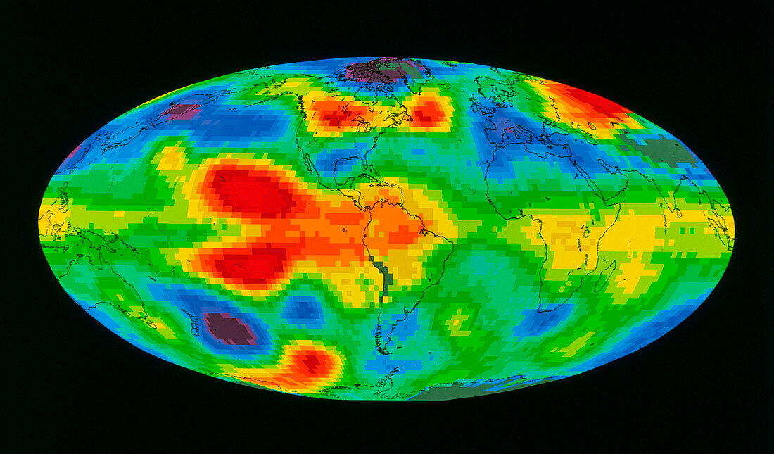
| False-colour TIROS-N satellite image of the Earth,showing temperature anomalies in the troposphere during the 1983 Pacific "El Nino" event. Red areas correspond to regions where the temperature is higher than the long-term average,while blue areas indicate regions whose temperatures are lower than the long-term average. The red area over the Pacific,off the coast of South America,is associated with the El Nino wind patterns. This climatic phenomenon recurs roughly every ten years,causing major changes in ocean circulation and severely affecting climate and biological productivity. Data provided by Spencer and Christy,NASA/MSFC | |
| Licence : | Droits gérés |
| Crédit: | Science Photo Library / NASA's Goddard Space Flight Center |
| Taille de l’image : | 4909 px × 2878 px |
| Model Release : | Non requis |
| Property Release : | Non requis |
| Restrictions : | - |
Prix pour cette image À partir de 45 €
Produit vendu
(Calendrier, Carte postale, Carte de vœux, Impression sur textile, Packaging etc)
À partir de 45 €
Usage commercial
(Affichage, Annonce presse, Annonce TV, Carte, Digital - hors rés. sociaux, Digital - rés. sociaux etc)
À partir de 45 €
Éditorial
(Digital, Journal, Livre, Livre pratique, Magazine, Télévision etc)
À partir de 60 €
Usage non-commercial
(Digital - hors rés. sociaux, Digital - rés. sociaux etc)
À partir de 120 €