Satellite map of Antarctic ozone hole,5/10/89
Numéro d’image : 11736305
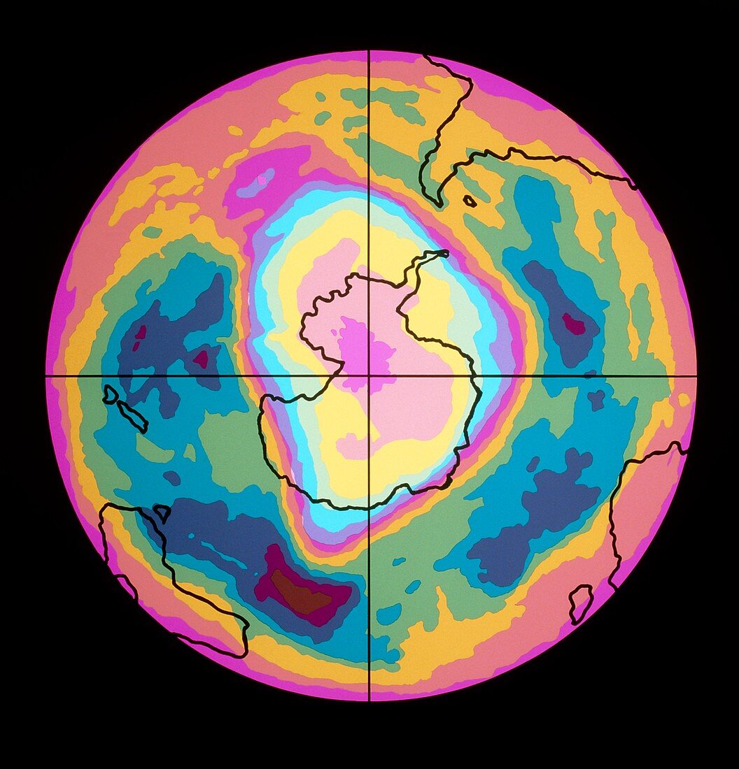
| Satellite map showing a severe depletion or "hole" in the ozone layer over Antarctica on October 5th,1989. The hole is probably due to pollution of the atmosphere by chlorofluorocarbons used in aerosols & refrigerants. First observed in 1980,the hole reaches a maximum in October,in Antarctic spring. It is seen here as the regions in shades of pink,yellow & light blue covering Antarctica (outlined in black) & a little beyond. The colours represent Dobson units,a measure of atmospheric ozone. The map was made by the Total Ozone Mapping Spectrometer (TOMS) on the American Nimbus-7 satellite,& coloured at Science Photo Library | |
| Licence : | Droits gérés |
| Crédit: | Science Photo Library / Coloured By John Wells / NASA |
| Taille de l’image : | 4106 px × 4276 px |
| Model Release : | Non requis |
| Property Release : | Non requis |
| Restrictions : | - |
Prix pour cette image À partir de 45 €
Produit vendu
(Calendrier, Carte postale, Carte de vœux, Impression sur textile, Packaging etc)
À partir de 45 €
Usage commercial
(Affichage, Annonce presse, Annonce TV, Carte, Digital - hors rés. sociaux, Digital - rés. sociaux etc)
À partir de 45 €
Éditorial
(Digital, Journal, Livre, Livre pratique, Magazine, Télévision etc)
À partir de 60 €
Usage non-commercial
(Digital - hors rés. sociaux, Digital - rés. sociaux etc)
À partir de 120 €