Satellite map of ozone layer northern hemisphere
Numéro d’image : 11736294
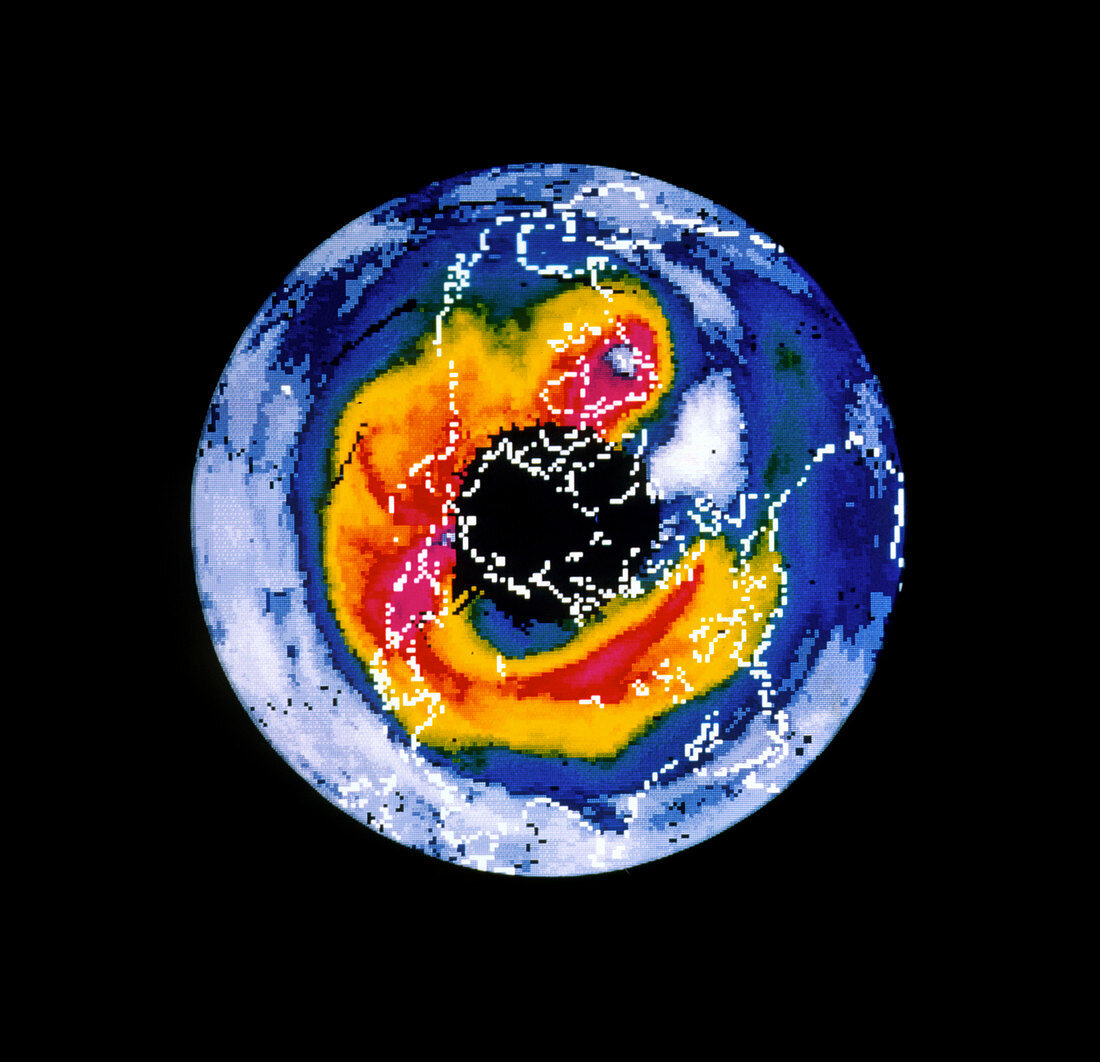
| Satellite map showing the ozone layer over the northern hemisphere on January 15,1986. The ozone is most concentrated (red & yellow) in a ring around the Arctic. The black area over the pole is where no data was obtained due to the Arctic night. The 1980 discovery of an annual depletion of the ozone layer over Antarctica - the "ozone hole" - has led to fears that the Arctic may also be affected. Some evidence of Arctic ozone loss was found in 1989. In this map of data obtained by the Nimbus 7 weather satellite,the continents are outlined in white. The colours represent Dobson units,a measure of atmospheric ozone | |
| Licence : | Droits gérés |
| Crédit: | Science Photo Library / LABORATORY FOR ATMOSPHERES, NASA GODDARD SPACE FLIGHT CENTER |
| Taille de l’image : | 3071 px × 2964 px |
| Model Release : | Non requis |
| Property Release : | Non requis |
| Restrictions : | - |
Prix pour cette image À partir de 45 €
Produit vendu
(Calendrier, Carte postale, Carte de vœux, Impression sur textile, Packaging etc)
À partir de 45 €
Usage commercial
(Affichage, Annonce presse, Annonce TV, Carte, Digital - hors rés. sociaux, Digital - rés. sociaux etc)
À partir de 45 €
Éditorial
(Digital, Journal, Livre, Livre pratique, Magazine, Télévision etc)
À partir de 60 €
Usage non-commercial
(Digital - hors rés. sociaux, Digital - rés. sociaux etc)
À partir de 120 €