Ozone hole over Antarctica,October 1987
Numéro d’image : 11736292
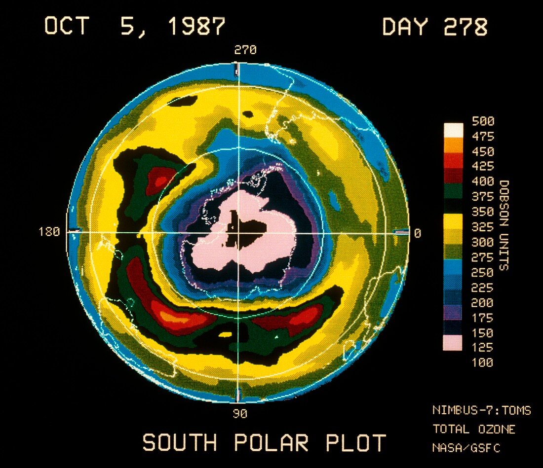
| Satellite map showing a severe depletion or "hole" in the ozone layer over Antarctica on October 5th,1987. The hole is probably due to pollution of the atmosphere by chlorofluorocarbons used in aerosols & refrigerants. First seen in 1980,the hole has grown each year since. It reaches a maximum in October,the Antarctic spring. It is visible here as the deep blue,purple,black & pink area covering Antarctica (outlined in white) & beyond. The colours represent Dobson units,a measure of atmospheric ozone,as shown in the colour scale at right. The map was made by the Total Ozone Mapping Spectrometer (TOMS) on the American Nimbus-7 weather satellite | |
| Licence : | Droits gérés |
| Crédit: | Science Photo Library / NASA |
| Taille de l’image : | 4551 px × 3927 px |
| Model Release : | Non requis |
| Property Release : | Non requis |
| Restrictions : | - |
Prix pour cette image À partir de 45 €
Produit vendu
(Calendrier, Carte postale, Carte de vœux, Impression sur textile, Packaging etc)
À partir de 45 €
Usage commercial
(Affichage, Annonce presse, Annonce TV, Carte, Digital - hors rés. sociaux, Digital - rés. sociaux etc)
À partir de 45 €
Éditorial
(Digital, Journal, Livre, Livre pratique, Magazine, Télévision etc)
À partir de 60 €
Usage non-commercial
(Digital - hors rés. sociaux, Digital - rés. sociaux etc)
À partir de 120 €