British Isles
Numéro d’image : 11736233
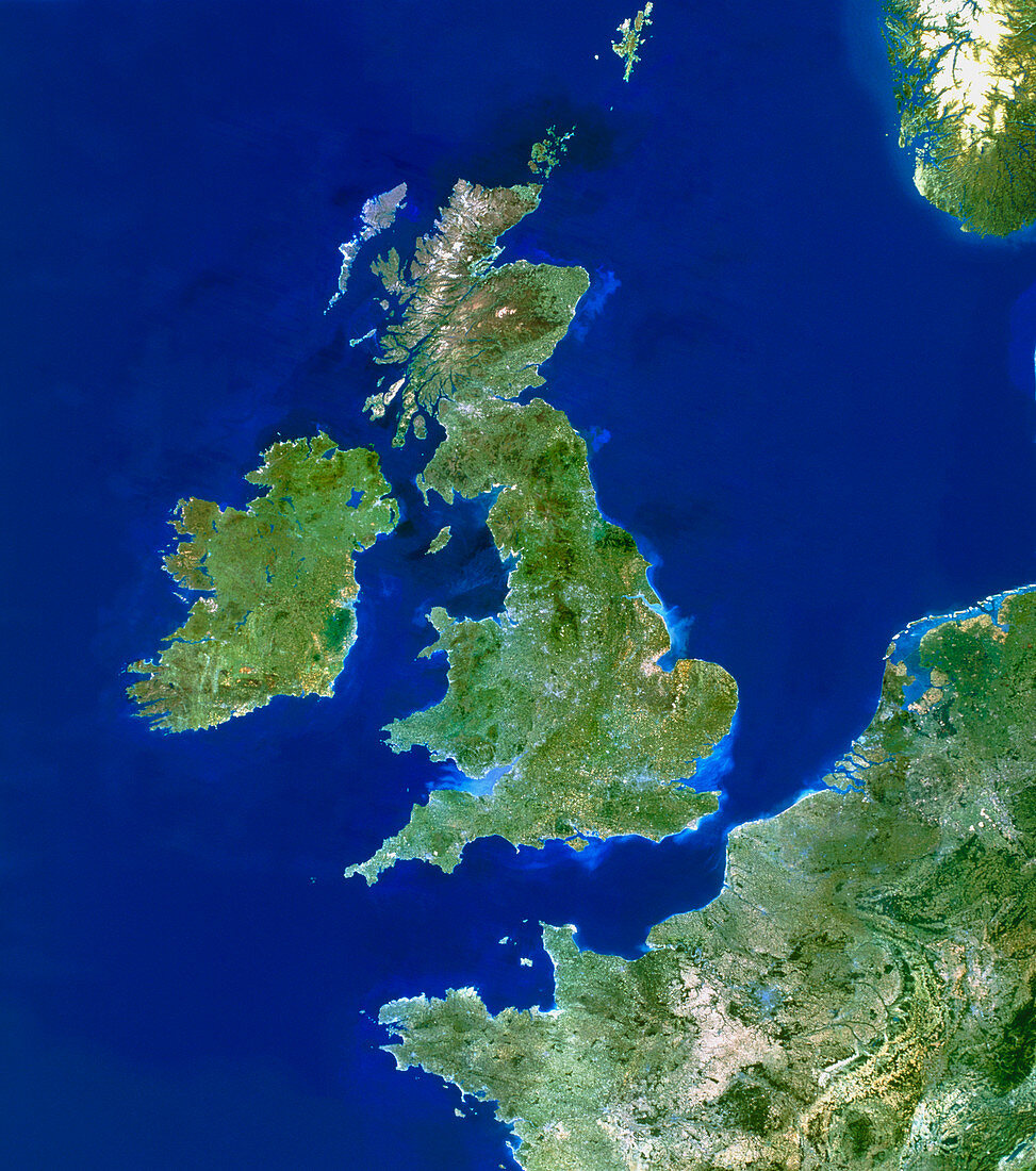
| British Isles. True-colour satellite image of the British Isles and northern France (lower right). North is at top. Water is blue,vegetation is green and snow,such as on Norway (top right),is white. Great Britain (centre) comprises England,Scotland and Wales,while Ireland consists of the Republic of Ireland and British Northern Ireland. Northern Ireland and Britain are together referred to as the United Kingdom. To the north-west of Scotland are the Outer Hebrides Islands. The North Sea is at upper right,with the Atlantic Ocean to the west of Ireland. In all there are about 5000 islands in the British Isles | |
| Licence : | Droits gérés |
| Crédit: | Science Photo Library / Planetobserver |
| Taille de l’image : | 4807 px × 5433 px |
| Model Release : | Non requis |
| Property Release : | Non requis |
| Restrictions : | - |
Prix pour cette image À partir de 45 €
Produit vendu
(Calendrier, Carte postale, Carte de vœux, Impression sur textile, Packaging etc)
À partir de 45 €
Usage commercial
(Affichage, Annonce presse, Annonce TV, Carte, Digital - hors rés. sociaux, Digital - rés. sociaux etc)
À partir de 45 €
Éditorial
(Digital, Journal, Livre, Livre pratique, Magazine, Télévision etc)
À partir de 60 €
Usage non-commercial
(Digital - hors rés. sociaux, Digital - rés. sociaux etc)
À partir de 120 €