British Isles
Numéro d’image : 11736232
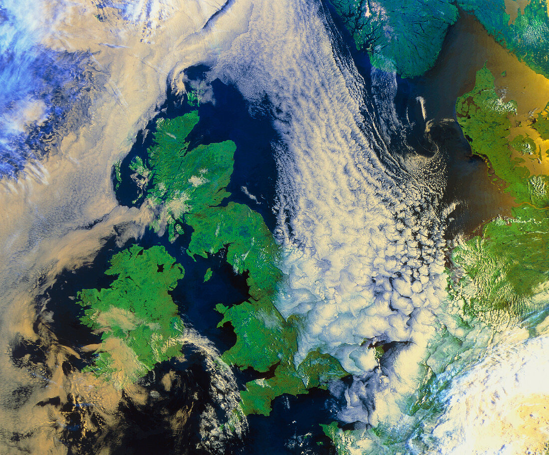
| British Isles. Satellite image of the British Isles partially obscured by dense cloud. North is towards the top left. This image approximates to true colours,with land appearing green,water blue and clouds white/pink. The British Isles are a group of islands off the coast of France (bottom right). The largest of these islands is Britain,with Ireland to its west. Denmark (upper right) is to the south of the southern tips of Norway (upper right) and Sweden (top right hand corner). This image was taken by the American NOAA-12 weather satellite on August 8 1995 | |
| Licence : | Droits gérés |
| Crédit: | Science Photo Library / University of Dundee |
| Taille de l’image : | 5423 px × 4492 px |
| Model Release : | Non requis |
| Property Release : | Non requis |
| Restrictions : | - |
Prix pour cette image À partir de 45 €
Produit vendu
(Calendrier, Carte postale, Carte de vœux, Impression sur textile, Packaging etc)
À partir de 45 €
Usage commercial
(Affichage, Annonce presse, Annonce TV, Carte, Digital - hors rés. sociaux, Digital - rés. sociaux etc)
À partir de 45 €
Éditorial
(Digital, Journal, Livre, Livre pratique, Magazine, Télévision etc)
À partir de 60 €
Usage non-commercial
(Digital - hors rés. sociaux, Digital - rés. sociaux etc)
À partir de 120 €