British Isles
Numéro d’image : 11736231
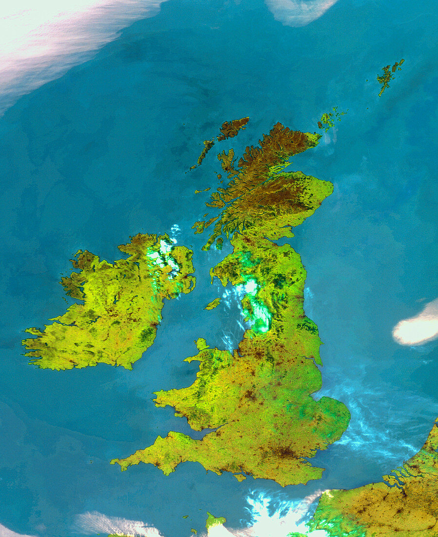
| British Isles. Satellite image of the British Isles. North is at top. The image approximates to true colours with land appearing green,water as blue and clouds mainly as white/pink. The British Isles are a group of islands off the coast of France (bottom right). The largest of these islands is Britain,with Ireland to its west. An almost totally cloudless area of high pressure,an anticyclone,lies over the British Isles. Anticyclones bring settled dry sunny weather. This image was taken by the American NOAA-14 weather satellite on June 27 1995 | |
| Licence : | Droits gérés |
| Crédit: | Science Photo Library / University of Dundee |
| Taille de l’image : | 3974 px × 4863 px |
| Model Release : | Non requis |
| Property Release : | Non requis |
| Restrictions : | - |
Prix pour cette image À partir de 45 €
Produit vendu
(Calendrier, Carte postale, Carte de vœux, Impression sur textile, Packaging etc)
À partir de 45 €
Usage commercial
(Affichage, Annonce presse, Annonce TV, Carte, Digital - hors rés. sociaux, Digital - rés. sociaux etc)
À partir de 45 €
Éditorial
(Digital, Journal, Livre, Livre pratique, Magazine, Télévision etc)
À partir de 60 €
Usage non-commercial
(Digital - hors rés. sociaux, Digital - rés. sociaux etc)
À partir de 120 €