Infrared satellite image of Ireland
Numéro d’image : 11736230
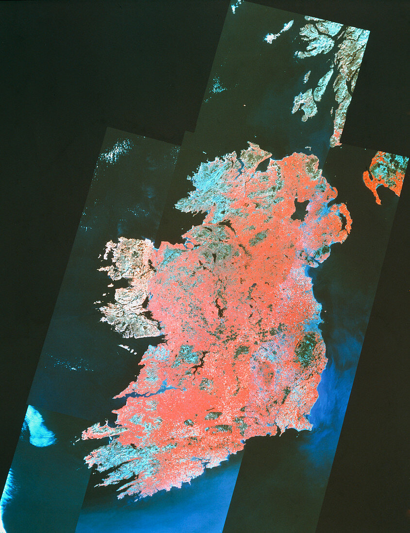
| Ireland. SPOT infrared satellite image of Ireland. North is at top. Urban areas,such as the capital of the Republic of Ireland,Dublin (centre right),and the capital of Northern Ireland,Belfast (upper right,on the north-east coast),are grey blue. Ireland is often called the "Emerald Isle" because of its lush vegetation (red in infrared images). The island is shaped like a basin,with central lowlands and hilly coastal ranges. It has many lakes (black),including the largest in the United Kingdom,Lough Neagh (upper right). The longest river in Ireland,the Shannon,ends at a long,narrow estuary at lower left | |
| Licence : | Droits gérés |
| Crédit: | Science Photo Library / MDA Information Systems |
| Taille de l’image : | 3792 px × 4939 px |
| Model Release : | Non requis |
| Property Release : | Non requis |
| Restrictions : | - |
Prix pour cette image À partir de 45 €
Produit vendu
(Calendrier, Carte postale, Carte de vœux, Impression sur textile, Packaging etc)
À partir de 45 €
Usage commercial
(Affichage, Annonce presse, Annonce TV, Carte, Digital - hors rés. sociaux, Digital - rés. sociaux etc)
À partir de 45 €
Éditorial
(Digital, Journal, Livre, Livre pratique, Magazine, Télévision etc)
À partir de 60 €
Usage non-commercial
(Digital - hors rés. sociaux, Digital - rés. sociaux etc)
À partir de 120 €