True-colour satellite image of Ulster,Ireland
Numéro d’image : 11736223
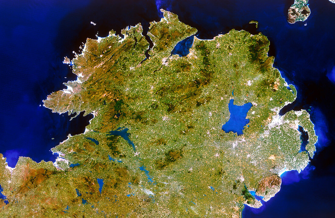
| Northern Ireland. Satellite image of Northern Ireland,also known as Ulster. The colours approximate to natural tones. North is at top. The capital of the province,Belfast,is at right,whilst the city of Londonderry is at upper centre. The largest lake in the British Isles,Lough Neagh,is at centre right. Lough Foyle (at top centre) and Strangford Lough (at far right) are two sea inlets which are almost totally enclosed by land. Image taken by the American Landsat-5 satellite | |
| Licence : | Droits gérés |
| Crédit: | Science Photo Library / Planetobserver |
| Taille de l’image : | 5516 px × 3591 px |
| Model Release : | Non requis |
| Property Release : | Non requis |
| Restrictions : | - |
Prix pour cette image À partir de 45 €
Produit vendu
(Calendrier, Carte postale, Carte de vœux, Impression sur textile, Packaging etc)
À partir de 45 €
Usage commercial
(Affichage, Annonce presse, Annonce TV, Carte, Digital - hors rés. sociaux, Digital - rés. sociaux etc)
À partir de 45 €
Éditorial
(Digital, Journal, Livre, Livre pratique, Magazine, Télévision etc)
À partir de 60 €
Usage non-commercial
(Digital - hors rés. sociaux, Digital - rés. sociaux etc)
À partir de 120 €