True-colour satellite image of northwest Scotland
Numéro d’image : 11736219
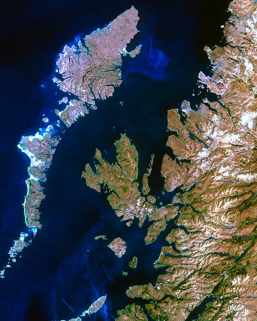
| Northwest Scotland. Satellite image of northwest Scotland,including the Hebrides islands. The colours approximate to natural tones. North is at top. The mainland is largely covered by the Highlands. The area at bottom right includes the highest point in the British Isles,Ben Nevis (1343 metres). The Hebrides are divided into two groups by the Little Minch Strait (at upper left). The largest Outer Hebrides and Inner Hebrides islands are Lewis with Harris (at upper left),and Skye (at centre) respectively. This region is very sparsely populated. Image taken by a Landsat-5 satellite | |
| Licence : | Droits gérés |
| Crédit: | Science Photo Library / Planetobserver |
| Taille de l’image : | 2947 px × 3682 px |
| Model Release : | Non requis |
| Property Release : | Non requis |
| Restrictions : | - |
Prix pour cette image À partir de 45 €
Produit vendu
(Calendrier, Carte postale, Carte de vœux, Impression sur textile, Packaging etc)
À partir de 45 €
Usage commercial
(Affichage, Annonce presse, Annonce TV, Carte, Digital - hors rés. sociaux, Digital - rés. sociaux etc)
À partir de 45 €
Éditorial
(Digital, Journal, Livre, Livre pratique, Magazine, Télévision etc)
À partir de 60 €
Usage non-commercial
(Digital - hors rés. sociaux, Digital - rés. sociaux etc)
À partir de 120 €