True-colour satellite image of southeast England
Numéro d’image : 11736214
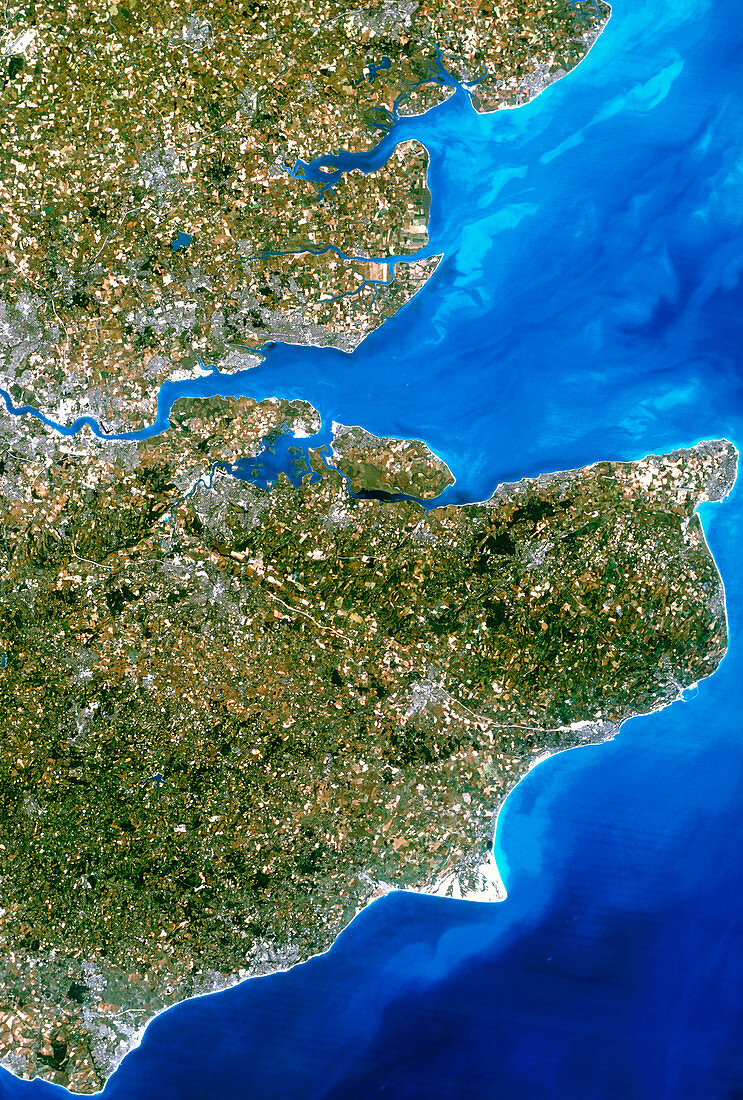
| Southeast England. True-colour satellite image of southeast England,featuring the counties of Kent (at centre right),Sussex (at lower left) and Essex (at upper centre). North is at top. The River Thames flows out from the eastern suburbs of London (at left). The estuary of the River Medway is at centre. Towns visible include Southend-on- Sea (at upper centre),Gillingham (on the Medway estuary) and Eastbourne (at bottom left). Numerous ports along the coast of Kent serve the sea traffic in the English Channel (at lower right). Image taken by an American Landsat-5 satellite | |
| Licence : | Droits gérés |
| Crédit: | Science Photo Library / Planetobserver |
| Taille de l’image : | 3422 px × 5063 px |
| Model Release : | Non requis |
| Property Release : | Non requis |
| Restrictions : | - |
Prix pour cette image À partir de 45 €
Produit vendu
(Calendrier, Carte postale, Carte de vœux, Impression sur textile, Packaging etc)
À partir de 45 €
Usage commercial
(Affichage, Annonce presse, Annonce TV, Carte, Digital - hors rés. sociaux, Digital - rés. sociaux etc)
À partir de 45 €
Éditorial
(Digital, Journal, Livre, Livre pratique, Magazine, Télévision etc)
À partir de 60 €
Usage non-commercial
(Digital - hors rés. sociaux, Digital - rés. sociaux etc)
À partir de 120 €