Satellite image of Liverpool and Manchester,UK
Numéro d’image : 11736209
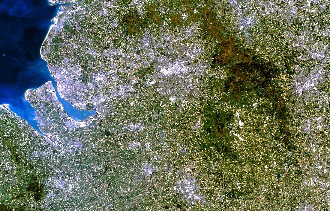
| Northwest England. True-colour satellite image of north-west England,Great Britain,including the cities of Liverpool (at centre left) and Manchester (at upper centre). North is at top. Other cities visible include Sheffield (at far right) and Stoke-on-Trent (at bottom centre). The mountainous area to the east of Manchester is the Peak District. River estuaries seen here include the Dee (at far left),the Mersey (at centre left),and the Ribble (at top left). Northwest England is a major industrial area. Image taken by a Landsat-5 satellite | |
| Licence : | Droits gérés |
| Crédit: | Science Photo Library / Planetobserver |
| Taille de l’image : | 5256 px × 3372 px |
| Model Release : | Non requis |
| Property Release : | Non requis |
| Restrictions : | - |
Prix pour cette image À partir de 45 €
Produit vendu
(Calendrier, Carte postale, Carte de vœux, Impression sur textile, Packaging etc)
À partir de 45 €
Usage commercial
(Affichage, Annonce presse, Annonce TV, Carte, Digital - hors rés. sociaux, Digital - rés. sociaux etc)
À partir de 45 €
Éditorial
(Digital, Journal, Livre, Livre pratique, Magazine, Télévision etc)
À partir de 60 €
Usage non-commercial
(Digital - hors rés. sociaux, Digital - rés. sociaux etc)
À partir de 120 €