Satellite image of Scotland
Numéro d’image : 11736208
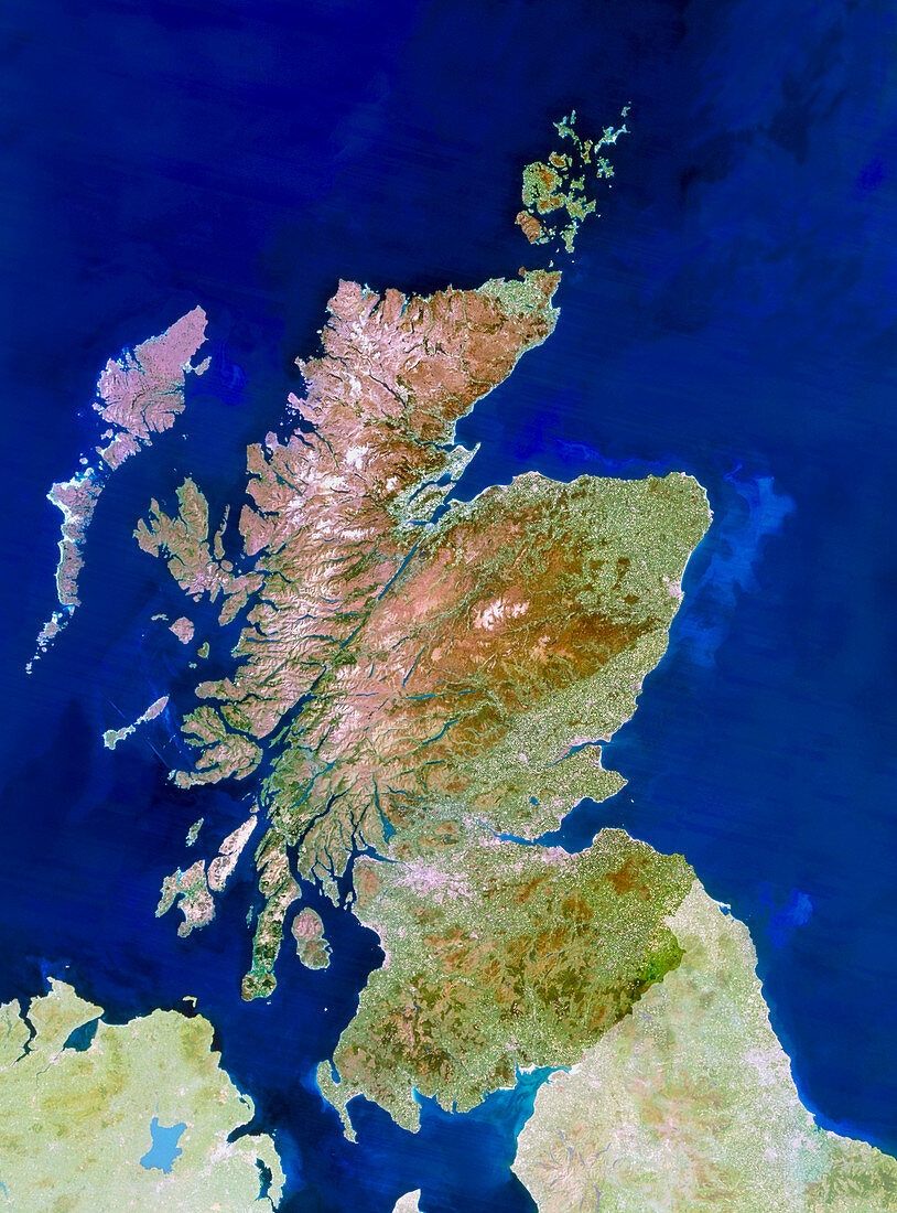
| Scotland. Satellite image of Scotland,a part of Great Britain. The colours approximate to natural tones,although other parts of Britain have been lightened to highlight Scotland. North is at top. Scotland is a mountainous country,the Grampian Mountains (at centre),Highlands (upper left) and Southern Uplands (lower centre) being visible here. The capital of Scotland,Edinburgh,lies on the east coast of the lowlands between the Grampians and the Southern Uplands. Glasgow is to the west of Edinburgh,whilst Aberdeen is at centre right. The Hebrides islands lie at upper left and the Orkney Isles are at top right. Image taken by the Landsat-5 satellite | |
| Licence : | Droits gérés |
| Crédit: | Science Photo Library / Planetobserver |
| Taille de l’image : | 3758 px × 5079 px |
| Model Release : | Non requis |
| Property Release : | Non requis |
| Restrictions : | - |
Prix pour cette image À partir de 45 €
Produit vendu
(Calendrier, Carte postale, Carte de vœux, Impression sur textile, Packaging etc)
À partir de 45 €
Usage commercial
(Affichage, Annonce presse, Annonce TV, Carte, Digital - hors rés. sociaux, Digital - rés. sociaux etc)
À partir de 45 €
Éditorial
(Digital, Journal, Livre, Livre pratique, Magazine, Télévision etc)
À partir de 60 €
Usage non-commercial
(Digital - hors rés. sociaux, Digital - rés. sociaux etc)
À partir de 120 €