True-colour satellite image of East Anglia,UK
Numéro d’image : 11736201
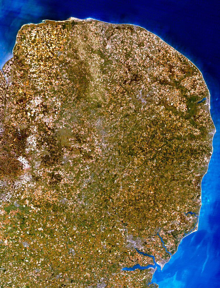
| East Anglia. Satellite image of East Anglia,England. The colours approximate to natural tones. North is at top. East Anglia is a predominantly low-relief agricultural area,as seen by the many green tones. Urban areas (grey) include Norwich (at upper right) and Ipswich (at lower right). The dark green area on the northeast coast is the Norfolk Broads,a famous inland waterway network. Note also the heavy sedimentation off shore (pale blue). The data for this image was gathered by the Landsat-5 satellite | |
| Licence : | Droits gérés |
| Crédit: | Science Photo Library / Planetobserver |
| Taille de l’image : | 3693 px × 4843 px |
| Model Release : | Non requis |
| Property Release : | Non requis |
| Restrictions : | - |
Prix pour cette image À partir de 45 €
Produit vendu
(Calendrier, Carte postale, Carte de vœux, Impression sur textile, Packaging etc)
À partir de 45 €
Usage commercial
(Affichage, Annonce presse, Annonce TV, Carte, Digital - hors rés. sociaux, Digital - rés. sociaux etc)
À partir de 45 €
Éditorial
(Digital, Journal, Livre, Livre pratique, Magazine, Télévision etc)
À partir de 60 €
Usage non-commercial
(Digital - hors rés. sociaux, Digital - rés. sociaux etc)
À partir de 120 €