Landsat image of Glasgow and Firth of Clyde
Numéro d’image : 11736184
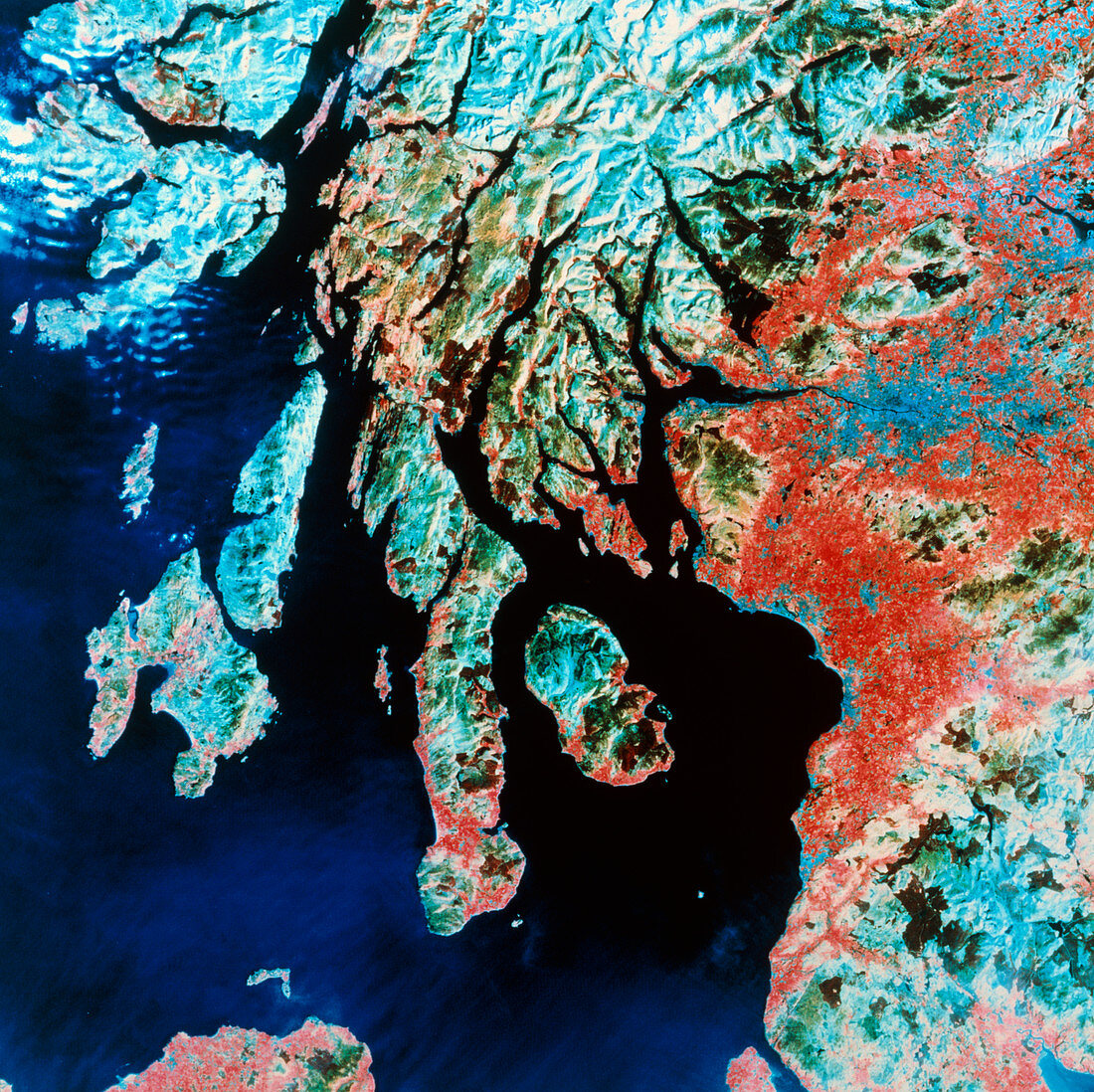
| Satellite image of the south-west of Scotland. In this false-colour view,arable land is shown as red and forests as dark green. Urban areas are dark blue,whilst upland grassland and moorland is shown as light blue. The city of Glasgow is just above right centre,at the head of the Firth of Clyde. Just below centre is the Isle of Arran,to the left of this is the long peninsula of Kintyre. The larger islands to the left are Jura (upper) and Islay (lower),famous for their whisky distilleries. At top left is the Isle of Mull,and at top centre is part of the Grampian Mountains. The data for this image were gathered by a Landsat satellite in April 1984 | |
| Licence : | Droits gérés |
| Crédit: | Science Photo Library / NRSC LTD |
| Taille de l’image : | 4821 px × 4812 px |
| Model Release : | Non requis |
| Property Release : | Non requis |
| Restrictions : | - |
Prix pour cette image À partir de 45 €
Produit vendu
(Calendrier, Carte postale, Carte de vœux, Impression sur textile, Packaging etc)
À partir de 45 €
Usage commercial
(Affichage, Annonce presse, Annonce TV, Carte, Digital - hors rés. sociaux, Digital - rés. sociaux etc)
À partir de 45 €
Éditorial
(Digital, Journal, Livre, Livre pratique, Magazine, Télévision etc)
À partir de 60 €
Usage non-commercial
(Digital - hors rés. sociaux, Digital - rés. sociaux etc)
À partir de 120 €