Landsat TM image of Yorkshire Dales (Malham Tarn)
Numéro d’image : 11736183
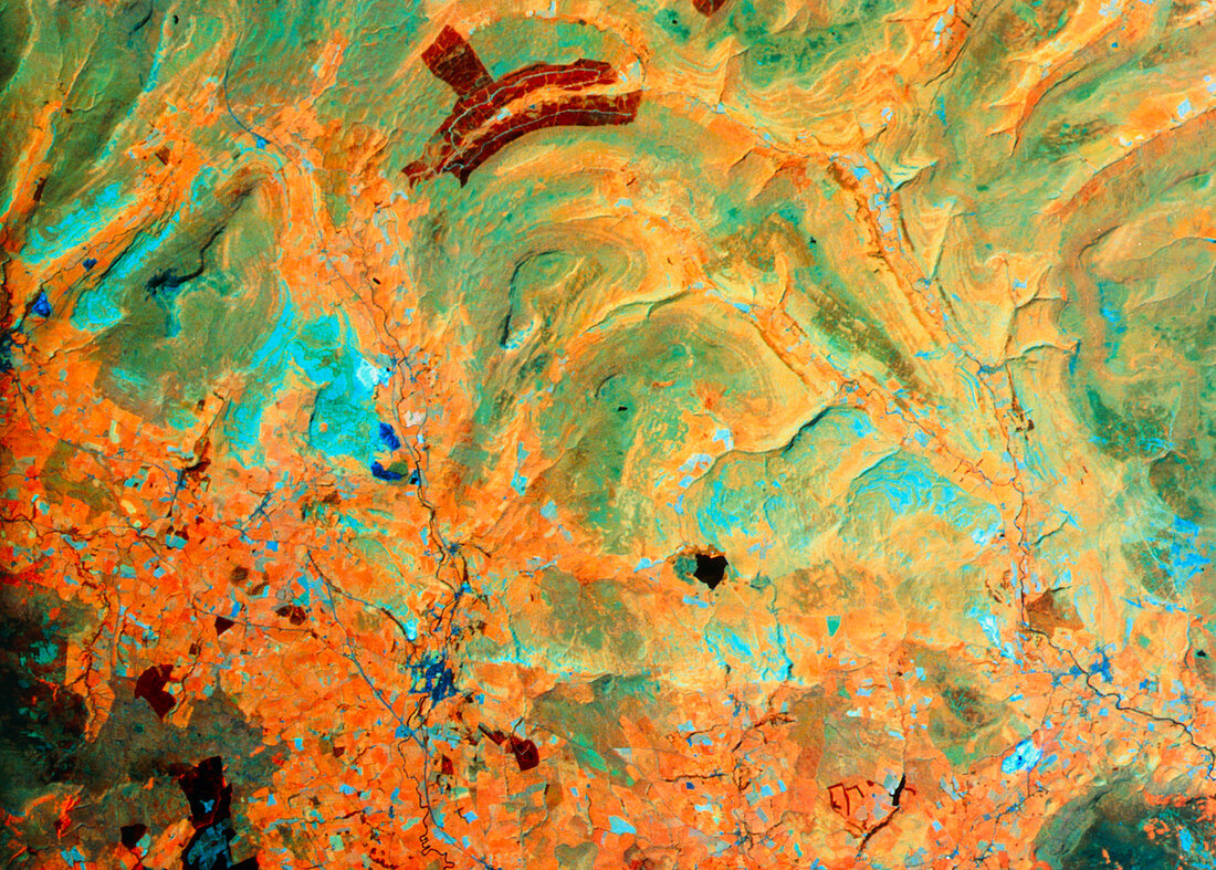
| Part of the Yorkshire Dales seen from space. This is a false-colour Landsat image,using infrared wavelengths. The orange colours represent open grassland,whilst the olive green colours represent upland moors. The dark brown area at top is planted forest. From this area,the River Wharfe runs toward the lower right through a valley (Wharfedale). To the left of the forest is the source of the River Ribble,which runs straight down to the bottom of the frame,passing through a dark blue patch,the town of Settle. Just toward lower right of centre is a lake - Malham Tarn. Topographical relief is well seen in this image | |
| Licence : | Droits gérés |
| Crédit: | Science Photo Library / NRSC LTD |
| Taille de l’image : | 4776 px × 3417 px |
| Model Release : | Non requis |
| Property Release : | Non requis |
| Restrictions : | - |
Prix pour cette image À partir de 45 €
Produit vendu
(Calendrier, Carte postale, Carte de vœux, Impression sur textile, Packaging etc)
À partir de 45 €
Usage commercial
(Affichage, Annonce presse, Annonce TV, Carte, Digital - hors rés. sociaux, Digital - rés. sociaux etc)
À partir de 45 €
Éditorial
(Digital, Journal, Livre, Livre pratique, Magazine, Télévision etc)
À partir de 60 €
Usage non-commercial
(Digital - hors rés. sociaux, Digital - rés. sociaux etc)
À partir de 120 €