Isle of Wight & Hampshire coast - August
Numéro d’image : 11736182
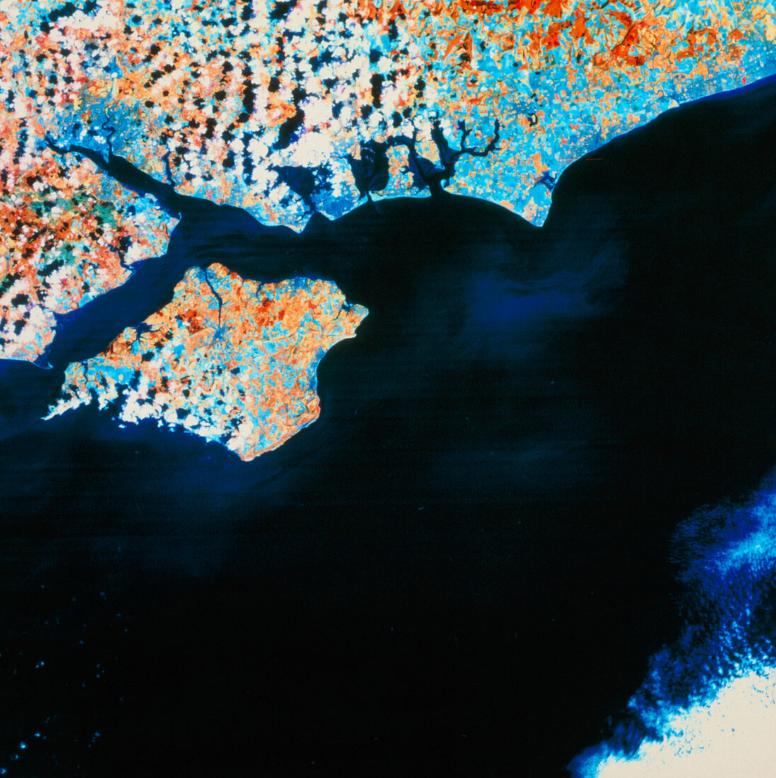
| Isle of Wight seen from space. False-colour image of the Hampshire coast and the Isle of Wight,made by the Landsat 5 satellite in August 1986. The colours represent different surface cover. The red areas are natural pasture in late summer growth,the pale blue areas are healthy crops approaching harvest and tended grass (parks,etc.). Mid- blue indicates urban areas. Two major ports are seen; Southampton (top left at end of estuary) and Portsmouth (just left of centre on coast). Between the Isle of Wight and the mainland is The Solent,most of the image being the English Channel. Compare with spring view E076/055 | |
| Licence : | Droits gérés |
| Crédit: | Science Photo Library / NRSC LTD |
| Taille de l’image : | 4571 px × 4582 px |
| Model Release : | Non requis |
| Property Release : | Non requis |
| Restrictions : | - |
Prix pour cette image À partir de 45 €
Produit vendu
(Calendrier, Carte postale, Carte de vœux, Impression sur textile, Packaging etc)
À partir de 45 €
Usage commercial
(Affichage, Annonce presse, Annonce TV, Carte, Digital - hors rés. sociaux, Digital - rés. sociaux etc)
À partir de 45 €
Éditorial
(Digital, Journal, Livre, Livre pratique, Magazine, Télévision etc)
À partir de 60 €
Usage non-commercial
(Digital - hors rés. sociaux, Digital - rés. sociaux etc)
À partir de 120 €