British Isles from space
Numéro d’image : 11736176
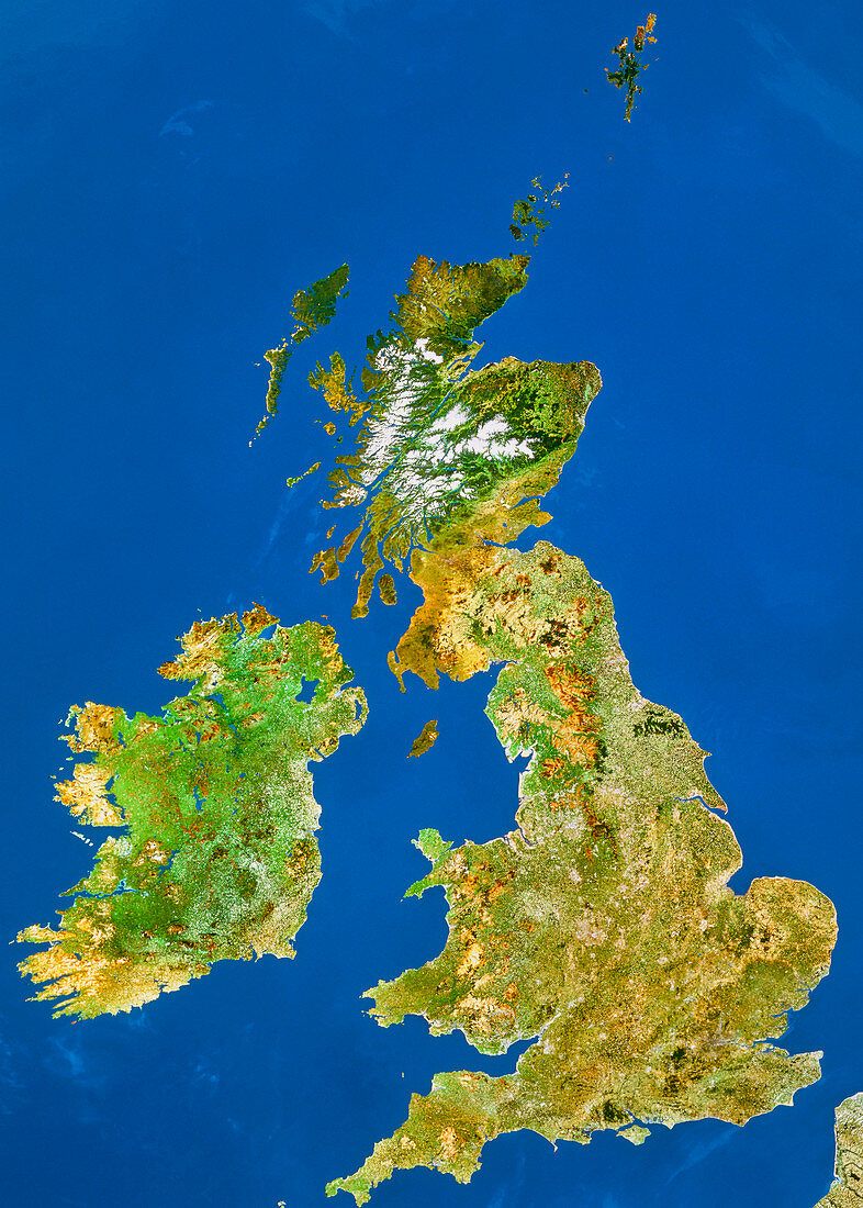
| The British Isles seen from space. This image is a mosaic of data gathered by Landsat satellites,with the colours processed to approximate to natural tones. Most of the UK appears as brownish green,indicating extensive agriculture. Brown areas in the West Country,Wales and northern England are sparse mountainous heathland vegetation. In Scotland,snow-covered mountains are seen with dark green coniferous forests below the snow line. Below this is a dark brown indicating moorland. Most of Eire has a mid-green colour indicative of rich pasture | |
| Licence : | Droits gérés |
| Crédit: | Science Photo Library / Worldsat Productions / NRSC |
| Taille de l’image : | 5268 px × 7372 px |
| Model Release : | Non requis |
| Property Release : | Non requis |
| Restrictions : |
|
Prix pour cette image À partir de 45 €
Produit vendu
(Calendrier, Carte postale, Carte de vœux, Impression sur textile, Packaging etc)
À partir de 45 €
Usage commercial
(Affichage, Annonce presse, Annonce TV, Carte, Digital - hors rés. sociaux, Digital - rés. sociaux etc)
À partir de 45 €
Éditorial
(Digital, Journal, Livre, Livre pratique, Magazine, Télévision etc)
À partir de 60 €
Usage non-commercial
(Digital - hors rés. sociaux, Digital - rés. sociaux etc)
À partir de 120 €
Mots clés
- Angleterre,
- de l'espace,
- Ecosse,
- géographie,
- Grande Bretagne,
- Grande-Bretagne,
- hautes terres,
- hauts plateaux,
- Iles Britanniques,
- image satellite,
- imagerie satellitaire,
- imagerie satellite,
- imagine de Landsat,
- Irlande,
- Irlande du Nord,
- Mer d'Irlande,
- montagnes,
- Pays de Galles,
- programme de Landsat,
- Royaume Uni,
- Royaume-Uni,
- science de la terre,
- sciences,
- Ulster