Landsat mosaic of British Isles
Numéro d’image : 11736172
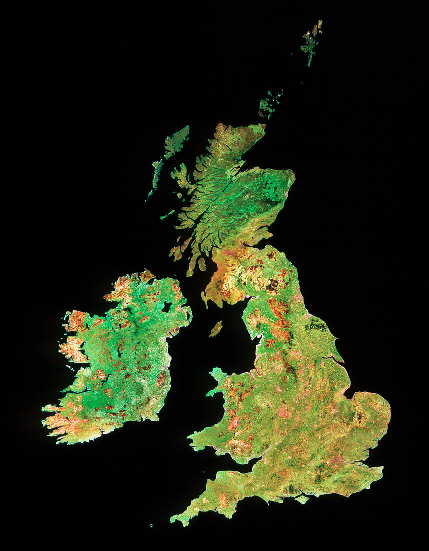
| The British Isles seen from space. This is a mosaic of images made by Landsat satellites,and approximates to natural colour. Most of the country is seen as various shades of green,indicating different surface vegetation cover. Major urban areas are seen as a pinkish brown. The Pennine mountains are shown as brown (about half- way up the island). The Highlands of Scotland are shown in strong relief,covered by dark green forest areas and paler green pastures in the valleys. This same pale green covers most of Ireland,with more mountainous moorlands on the south and west coasts | |
| Licence : | Droits gérés |
| Crédit: | Science Photo Library / NRSC LTD |
| Taille de l’image : | 2759 px × 3543 px |
| Model Release : | Non requis |
| Property Release : | Non requis |
| Restrictions : | - |
Prix pour cette image À partir de 45 €
Produit vendu
(Calendrier, Carte postale, Carte de vœux, Impression sur textile, Packaging etc)
À partir de 45 €
Usage commercial
(Affichage, Annonce presse, Annonce TV, Carte, Digital - hors rés. sociaux, Digital - rés. sociaux etc)
À partir de 45 €
Éditorial
(Digital, Journal, Livre, Livre pratique, Magazine, Télévision etc)
À partir de 60 €
Usage non-commercial
(Digital - hors rés. sociaux, Digital - rés. sociaux etc)
À partir de 120 €