True-colour Landsat satellite mosaic of Bangladesh
Numéro d’image : 11736044
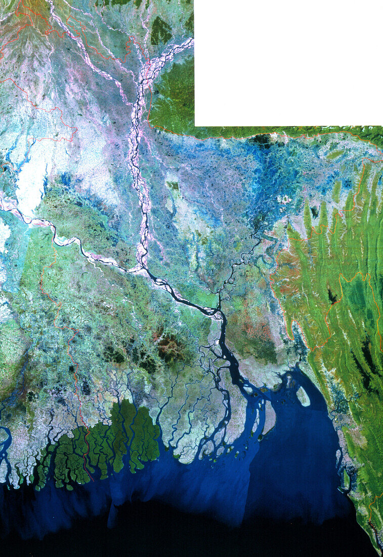
| Bangladesh. True-colour Landsat satellite mosaic image of Bangladesh. North is at top. Vegetation is green and water blue/black. Bangladesh (outline in red) is mainly a floodplain and contains many rivers. The Jamuna (below river junction at upper left) meets the Ganges (at far left) to form the Padma. The Meghna (running from upper right) gives its name to this river where they join,before splitting into many channels in the Ganges Delta as it runs into the Bay of Bengal (lower frame). The capital Dhaka (pale pink) is at centre and marshland (blue) is at upper right. Image taken in January and February. Image area: 390x530 km | |
| Licence : | Droits gérés |
| Crédit: | Science Photo Library / MDA Information Systems |
| Taille de l’image : | 2480 px × 3605 px |
| Model Release : | Non requis |
| Property Release : | Non requis |
| Restrictions : | - |
Prix pour cette image À partir de 45 €
Produit vendu
(Calendrier, Carte postale, Carte de vœux, Impression sur textile, Packaging etc)
À partir de 45 €
Usage commercial
(Affichage, Annonce presse, Annonce TV, Carte, Digital - hors rés. sociaux, Digital - rés. sociaux etc)
À partir de 45 €
Éditorial
(Digital, Journal, Livre, Livre pratique, Magazine, Télévision etc)
À partir de 60 €
Usage non-commercial
(Digital - hors rés. sociaux, Digital - rés. sociaux etc)
À partir de 120 €