Infrared satellite image of Italy
Numéro d’image : 11736043
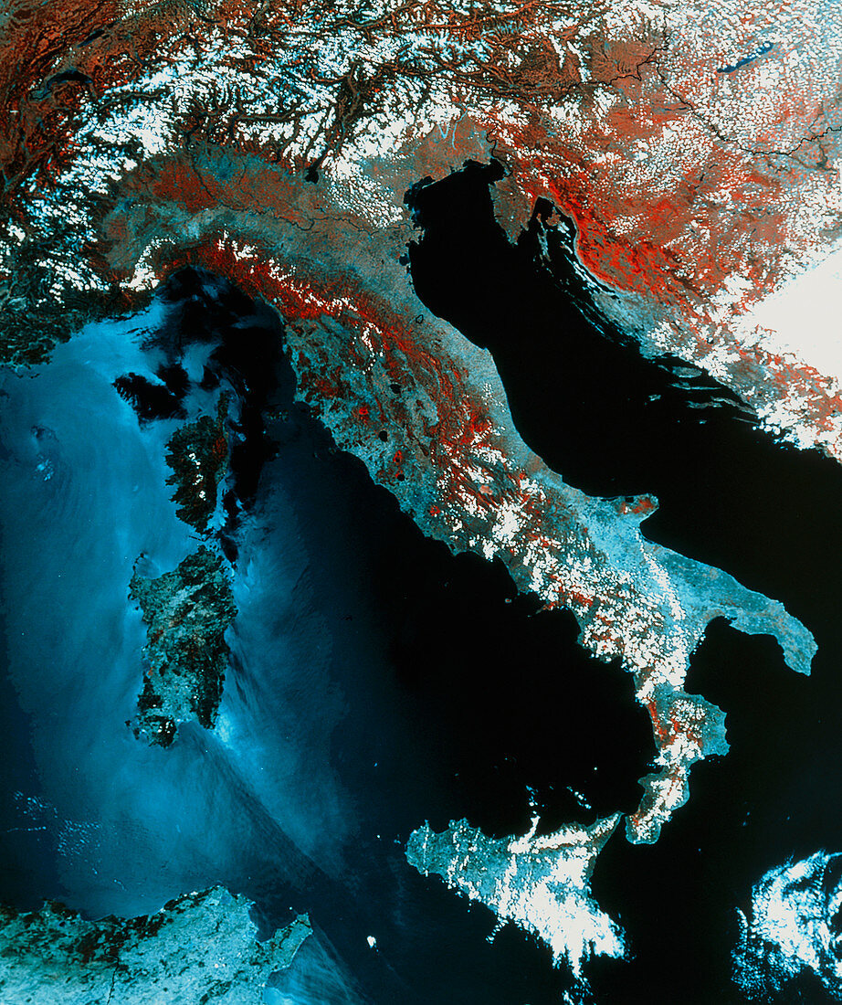
| Italy. Infrared satellite image of Italy and the central Mediterranean Sea. North is towards top. In infrared,water is blue/black,green vegetation is red,snow and clouds are white and bare ground is light blue/grey. The Alps are in the north of the image with a coating of snow. The Apennine mountains which form the "spine" of Italy appear red. To the west of Italy are the islands of Corsica (upper,part of France) and Sardinia. At bottom centre is the island of Sicily. To the east of Italy is the Adriatic Sea. Image taken by a Landsat satellite in July | |
| Licence : | Droits gérés |
| Crédit: | Science Photo Library / MDA Information Systems |
| Taille de l’image : | 4159 px × 4963 px |
| Model Release : | Non requis |
| Property Release : | Non requis |
| Restrictions : | - |
Prix pour cette image À partir de 45 €
Produit vendu
(Calendrier, Carte postale, Carte de vœux, Impression sur textile, Packaging etc)
À partir de 45 €
Usage commercial
(Affichage, Annonce presse, Annonce TV, Carte, Digital - hors rés. sociaux, Digital - rés. sociaux etc)
À partir de 45 €
Éditorial
(Digital, Journal, Livre, Livre pratique, Magazine, Télévision etc)
À partir de 60 €
Usage non-commercial
(Digital - hors rés. sociaux, Digital - rés. sociaux etc)
À partir de 120 €