USA
Numéro d’image : 11736031
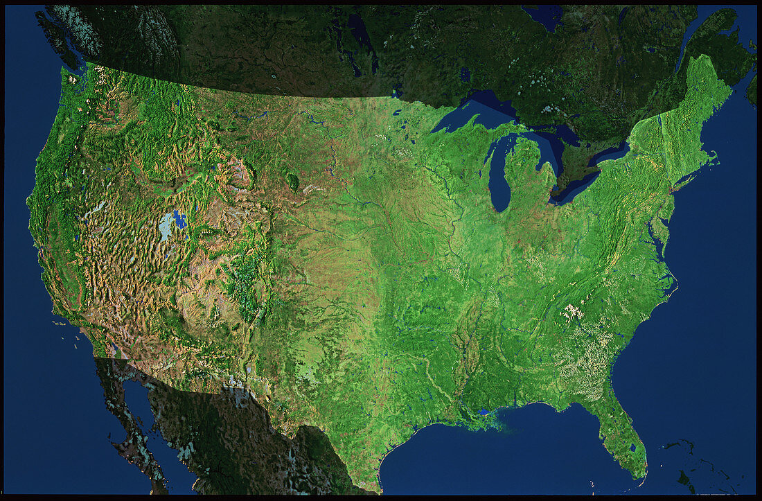
| Satellite image of the USA. The colours in this mosaic have been processed to represent natural tones. Seen here are the 48 contiguous states of the USA (ie excluding Alaska and Hawaii). Two main mountain ranges are seen in clear relief: the Rocky Mountains of the west (left) and the Appalachians in the east. The east half of the USA is dominated by extensive agriculture (light green),whilst the west has upland deserts (pale brown) and the fertile west coast strip of California,Oregon and Washington State (dark green). At north is Canada and south is Mexico | |
| Licence : | Droits gérés |
| Crédit: | Science Photo Library / Worldsat International |
| Taille de l’image : | 4742 px × 3116 px |
| Model Release : | Non requis |
| Property Release : | Non requis |
| Restrictions : |
|
Prix pour cette image À partir de 45 €
Produit vendu
(Calendrier, Carte postale, Carte de vœux, Impression sur textile, Packaging etc)
À partir de 45 €
Usage commercial
(Affichage, Annonce presse, Annonce TV, Carte, Digital - hors rés. sociaux, Digital - rés. sociaux etc)
À partir de 45 €
Éditorial
(Digital, Journal, Livre, Livre pratique, Magazine, Télévision etc)
À partir de 60 €
Usage non-commercial
(Digital - hors rés. sociaux, Digital - rés. sociaux etc)
À partir de 120 €