Landsat mosaic of North Korea
Numéro d’image : 11736030
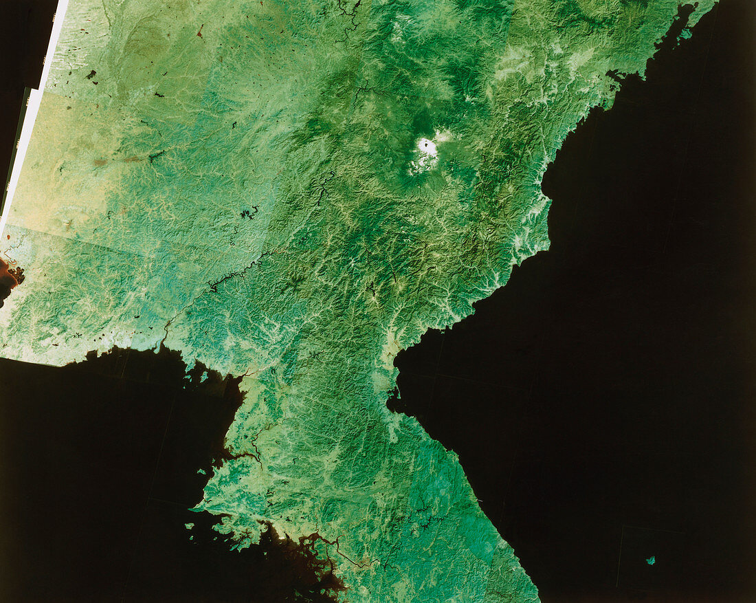
| Satellite image of North Korea. The colours in this image have been processed to approximate to true tones. The border between North and South Korea runs from the estuary on the west coast (bottom centre) toward centre right. Just below this line is a brownish patch - this is Seoul,capital of South Korea. North Korea's border with China runs along the river left of centre,cuts below the white snow-capped volcano then almost parallel to the coast toward top right. The dominant mountain terrain (dark green) of North Korea is very evident,mixed with lowland scrub (pale green). This image is a mosaic of frames made by a Landsat satellite | |
| Licence : | Droits gérés |
| Crédit: | Science Photo Library / Restec, Japan |
| Taille de l’image : | 5375 px × 4285 px |
| Model Release : | Non requis |
| Property Release : | Non requis |
| Restrictions : |
|
Prix pour cette image À partir de 45 €
Produit vendu
(Calendrier, Carte postale, Carte de vœux, Impression sur textile, Packaging etc)
À partir de 45 €
Usage commercial
(Affichage, Annonce presse, Annonce TV, Carte, Digital - hors rés. sociaux, Digital - rés. sociaux etc)
À partir de 45 €
Éditorial
(Digital, Journal, Livre, Livre pratique, Magazine, Télévision etc)
À partir de 60 €
Usage non-commercial
(Digital - hors rés. sociaux, Digital - rés. sociaux etc)
À partir de 120 €